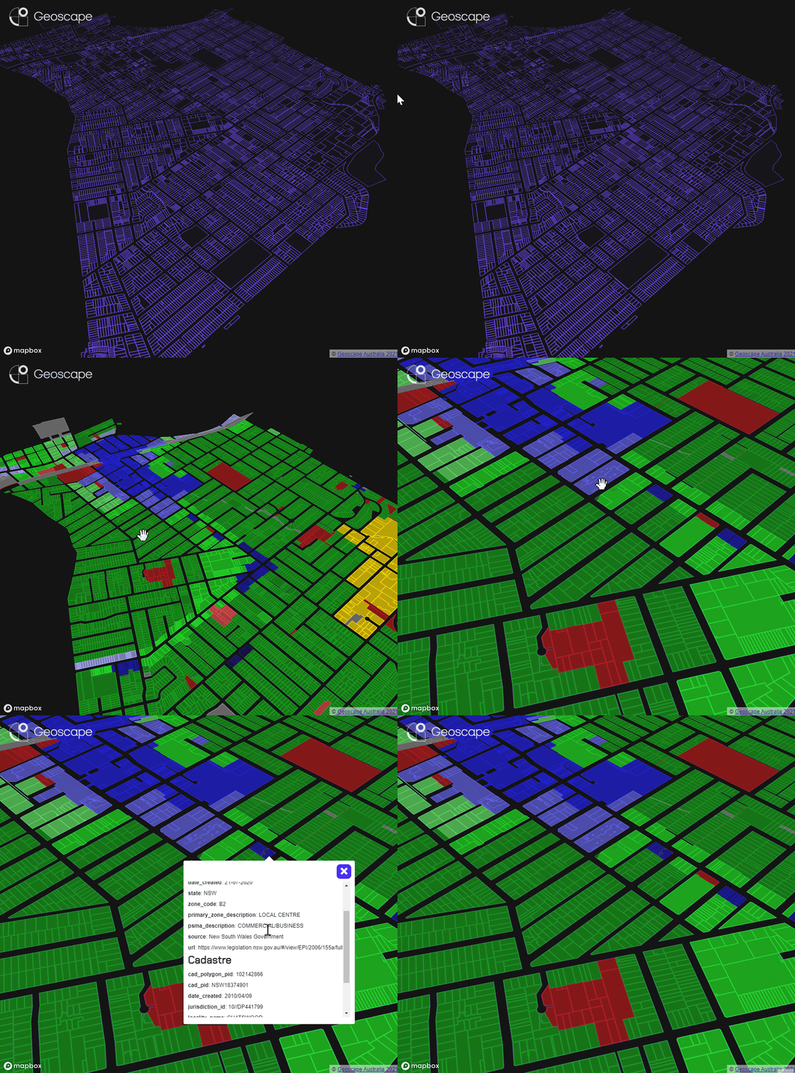
Geoscape Land Parcels groups spatial information about the boundaries of parcels of land that can be bought and sold, and associated with an address, along with development potential.
Geoscape Land Parcels includes Cadastre, Property, Planning and Planning Insights datasets for a combined complete picture of the property. Designed to link with each other, land parcels datasets have detailed information such as strata, planning zones and land boundaries.
With Geoscape Land Parcels you can eliminate multiple data sources, understand the complexity of sites with Strata titles, detailed zoning codes, access nationally consistent planning classifications in a standardised way and even dive deeper into permitted and prohibited use of land and whether there are intersecting bushfire, flood, infrastructure, heritage or industry overlays.
Enhance market analysis, insurance assessments and land valuation with consistent national coverage. We’ve done the hard work for you, access full states or select just the area you need for a ready-to-use base for your next project.
Download the Geoscape Land Parcels brochure
Get in touch with us
Datasets available in Land Parcels
Cadastre
Geoscape Cadastral parcels represent the smallest legal area of land capable of sale without the need for further approval to subdivide. The parcels can be referenced by a land title which links to jurisdictional information such as valuation information, land descriptions and certificate of title or crown lease. Jurisdictional information is provided through the state or territory land registries.
Geoscape Cadastre can be connected to the Geocoded National Address File (G-NAF) and Geoscape address services through common address information. It can also be used with other Geoscape data including Buildings, Property and Planning for a full spatial picture of the built environment.
Property
Geoscape Property is a seamless national representation of Australia’s property parcels. A property is an area of land recognised by local governments as a singular valued/rateable entity. You can filter the data to only show non-overlapping properties with an outer boundary for each. For powerful insights, connect Property to the Cadastre dataset for a complete understanding of the structure of complex land holdings and information for management for rates issuance.
Property can be linked with jurisdiction data for assessing the valuation of properties and other analytics such as asset performance.
Planning
Geoscape Planning provides information about the type of development that may occur at a location. It details the planning zone codes that apply across Australia and connects to Geoscape Cadastre to create a spatial representation of planning information at a parcel level.
Planning zone codes vary across state, territory and local governments. Geoscape Planning aggregates these and assigns a national planning zone attribute to each land parcel for consistency of planning information.
The data source and URL attributes are an easy reference to the relevant state or local government planning authority for further information on the restrictions and permitted activities associated with the development site.
Planning Insights
Geoscape Planning Insights is aggregated and enhanced planning information about the development potential of land across Australia. It provides a comprehensive understanding of the urban environment, how it changes, and the specific planning information or regulations applicable to a cadastre parcel or an address.
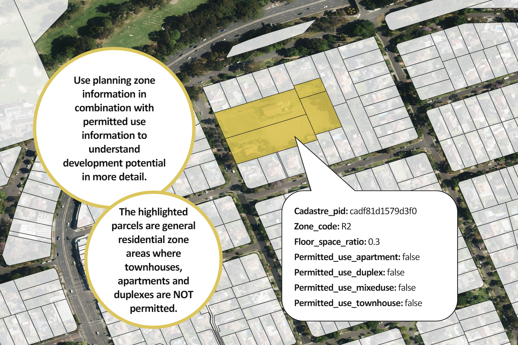
Planning Insights contains detailed zoning information, and dives even deeper into permitted and prohibited uses of the land and whether there are intersecting bushfire, flood, infrastructure, heritage or industry overlays.
Planning Insights is designed to provide insight at both a local and broader scale. It can be used in a wide range of commercial, government and research use cases including population forecasting, property valuations, and asset risk
Download Geoscape Planning Insights datasheet
Download Geoscape Planning Insights product guide
How can you use Cadastre, Property, Planning and Planning Insights?
Urban Design and Planning
Use the detailed zoning information to guide site selection and research the viability and impact of a proposed development.
Real Estate
Connect property sales data with land parcels to understand land bought and sold, track the location and attributes of land being transacted and identify emerging trends.
Analytics
Combining Geoscape Cadastre, Planning and Property for detailed spatially accurate analytics.
Informed Site Selection
Select appropriate locations for retail or community centres, Census analysis, Centrelink support, health services, transport and regional development.
Government
Planning information indicates how Australia could be developed. Use it as a framework for modelling potential growth in population, hosing and industry, and its impacts nationally.
Site Management
Assess a specific site at an address ahead of undertaking works to understand where its boundaries are, any complexity in its structure and have information to make further queries on site usage, rights, restrictions and responsibilities.
Learn more about Datasets Attributes
Cadastre helps understand parcel boundaries and site complexity with a digital representation of land titles.
- Parcel ID allows for a direct lookup of the parcels title information in the jurisdictions Land Registry.
- Parcel ID also provides the linkage of Cadastre with G-NAF and Geoscape Address Services.
- Lot & Plan information that uniquely identifies the parcel in a plan.
- Parcel Type either Lot, Strata, Stratum or Road.
- Base Parcel enables visualisation and analytics across a non-overlapping layer of parcels.
- Strata Type either Horizontal (townhouses) or Vertical (apartments).
- Total Strata Count.
- Horizontal and Vertical Strata Count.
- Area in square metres.
Property provides the representation of land boundaries used by the jurisdictions and local government for land valuation and the issuance of rates notices.
- Contributor ID provides a searchable identifier that can be used to find land valuation and rates information from the jurisdiction.
- Base Property allows for visualisation and analytics across a non-overlapping layer of parcels.
- Area in square metres.
- Property and Cadastre linkage provides a definition of the relationship between the Cadastre and Property.
Planning provides detailed planning zone codes and descriptions for parcels of land with links to relevant planning schemes or instruments.
- Zone Code as defined by the planning authority.
- Primary Zone provides a description defining the primary zone assigned to the parcel.
- Secondary Zone provides further detail where defined for a planning zone.
- National Zone classification provides an aggregated view of planning across Australia.
Planning provides deeper insights into the development potential of the land.
- Planning zone codes as provided by the jurisdiction or council, including descriptive and ancillary information about the planning zone and use.
- Planning overlays describes the details of any bushfire, flood, infrastructure, heritage or industry overlays that intersect with the location of interest.
- Permitted and prohibited uses of the land, including whether apartments, townhouses, or duplexes are permitted at the location,
- Linkage to cadastre and G-NAF to spatially-enable the insights that can be drawn from the data
Get Geoscape Land Parcels
Geoscape Self-serve Data Distribution Platform
Self-select and download just what you need – Cadastre, Planning
Formats:
- ESRI Shapefile
- Autodesk DWG
Geoscape Authorised Partners
The dataset is also available under licence from Geoscape authorised partners.
Additionally, if you are looking at building next-generation solutions for your customers, our partner program may be a perfect fit.
Unlock the power of spatial data by choosing the right partnership for your business.
Full Datasets
Whole-of-Australia data, when you just need it all – Cadastre, Planning and Property
Formats:
- ESRI Shapefile
- MapInfo TAB
- File Geodatabase
- GeoJSON
Try sample data
Want to try it out? Check out our sample data visualisation and download our Chatswood sample area.
You can also try Geoscape Planning Insights sample data
Get Planning Insights sample data

Trusted by
Banner header image created using aerial imagery © Aerometrex Ltd 2023, and Geoscape Planning Insights © Geoscape Australia 2023 Copyright and Disclaimer Notice
