Case Studies
Geoscape data and services enable your success. Read about how our customers are automating processes with one-click integrations, reducing costs and improving efficiency.
Geoscape’s custom solution for TomTom allowed the company to reduce its cycle time for getting new addresses into its location technology and services.
Learn more
NSW Point, an address validation tool used by NSW government agencies, makes more than 1 million Geoscape API calls a week. Seamlessly integrated into online forms and supporting real-time transaction analysis, Spatial Services shows how Geoscape APIs streamline reliable service delivery across government.
Learn more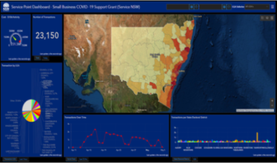
Geoscape’s Buildings data is an essential layer of Ambient’s national 3D transport noise map.
Learn more
Geoscape’s up-to-date address data made it easy for the public to apply for border passes using an efficient, citizen-focused service developed by state and territory governments.
Learn more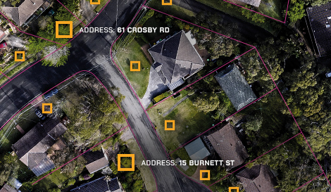
The case study focusses on Australian Bureau of Statistics leveraging Geoscape API products and professional services to assist in the Census online experience.
Learn more
The case study focuses on the University of Queensland’s custom data requirement for ready-to-use, parcel-level land use data in a spatial format that adopted the national land use naming convention.
Learn more
Small address inaccuracies were having a big impact on the ACT Government, resulting in duplication of jobs and hours of wasted time and effort. Since implementing Geoscape’s address verification APIs, they’ve saved time and money, and noted an increase in employee and customer satisfaction.
Learn more
SLR Consulting relies on Geoscape Data on Demand for noise, air quality modelling and visual amenity assessments. Access to ready-to-use building outlines, heights and addresses helps them forecast the impact of major facility and infrastructure projects quickly and confidently, while controlling data costs.
Learn more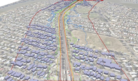
WindTech are Australian leaders in wind modelling and the analysis of wind effects. They create models of buildings and measure how they move in wind tunnel testing. Geoscape buildings data simplified and automated their previously manual process.
Learn more
The Energy & Water Ombudsman NSW uses Geoscape APIs to prevent address errors being typed into its online complaints form, support its reporting obligations, and deliver customer support programs.
Learn more
GHD developed noise models for Australian Industrial Energy to identify areas affected by the proposed Port Kembla Gas Terminal and estimates using Geoscape cut the cost of producing a noise model by at least 50 per cent.
Learn more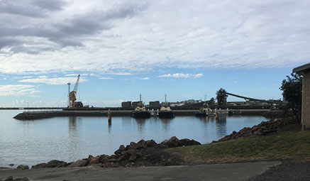
ACT Emergency Services Agency have been integrating G-NAF data in to their tech mapping for over 15 years. G-NAF helps emergency responders locate an exact address in their ambulance on-board computers.
Learn more
Sensing Value seamlessly combined Geoscape data, including building footprints, heights, trees and surface cover, with other data in digital city models to revolutionise regulatory development. It enables local councils to simulate how land use planning decisions will affect the future functioning of Launceston.
Learn more