Key Features

Comprehensive national data
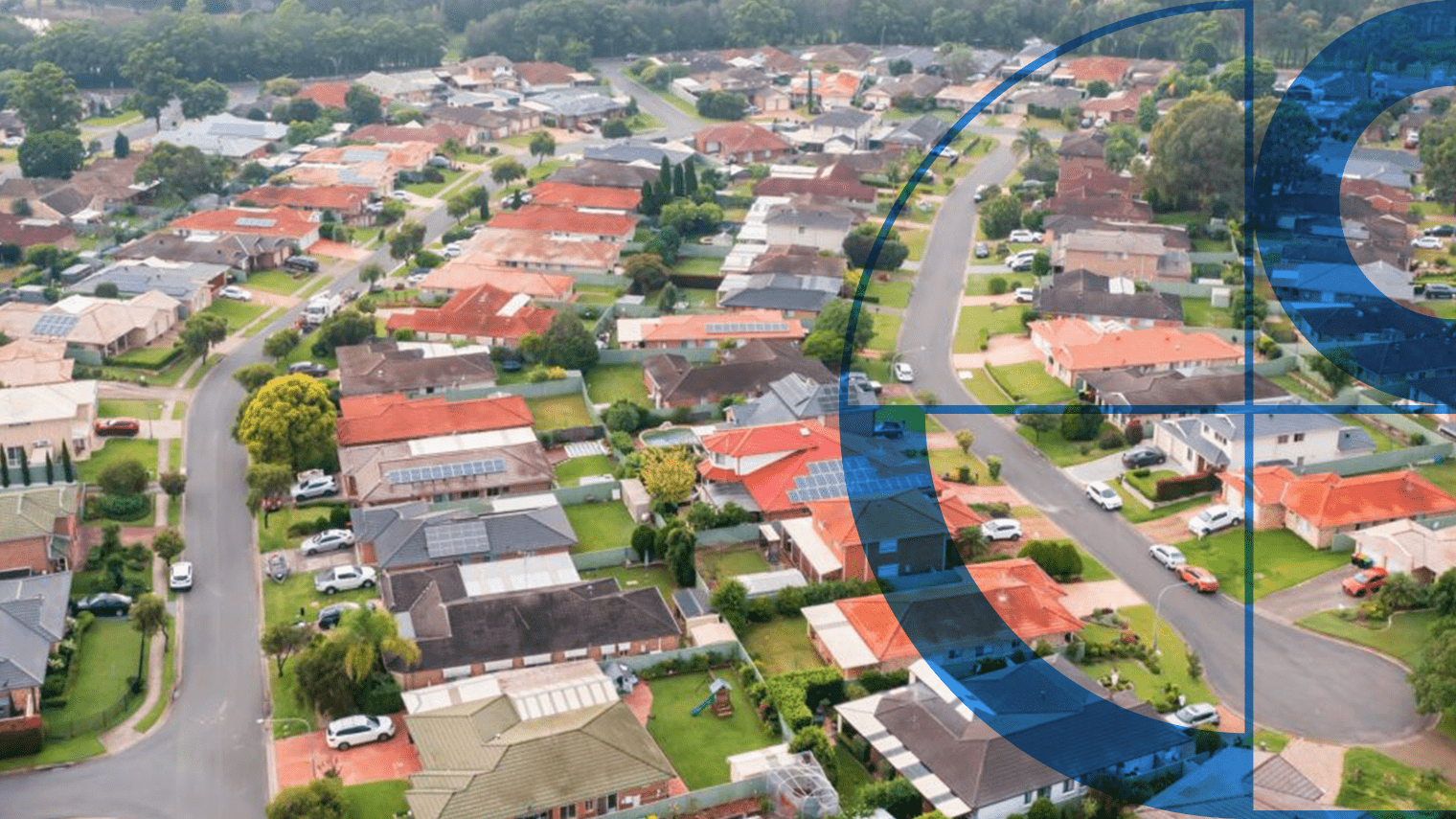
Covering every building in Australia with consistent standards across all states and territories.

Consistently updated
Data derived from satellite and aerial imagery, regularly refreshed to ensure accuracy and currency.

High quality data
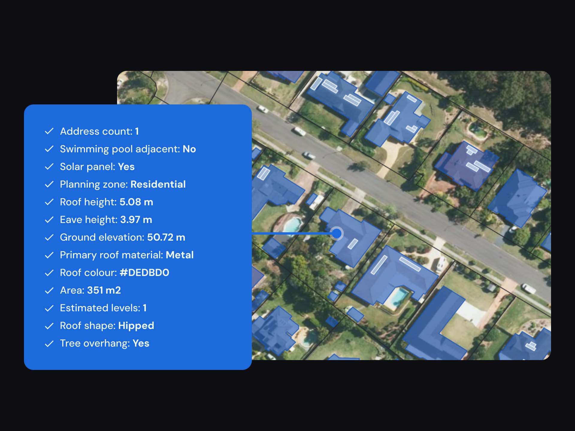
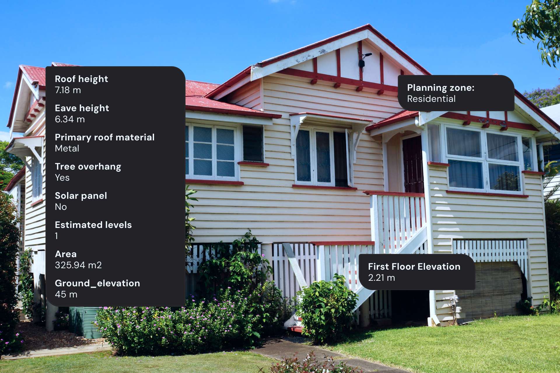
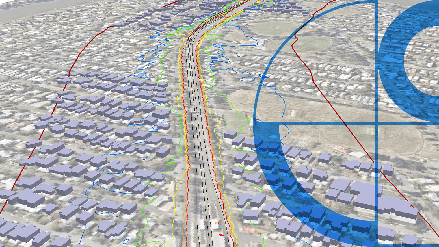
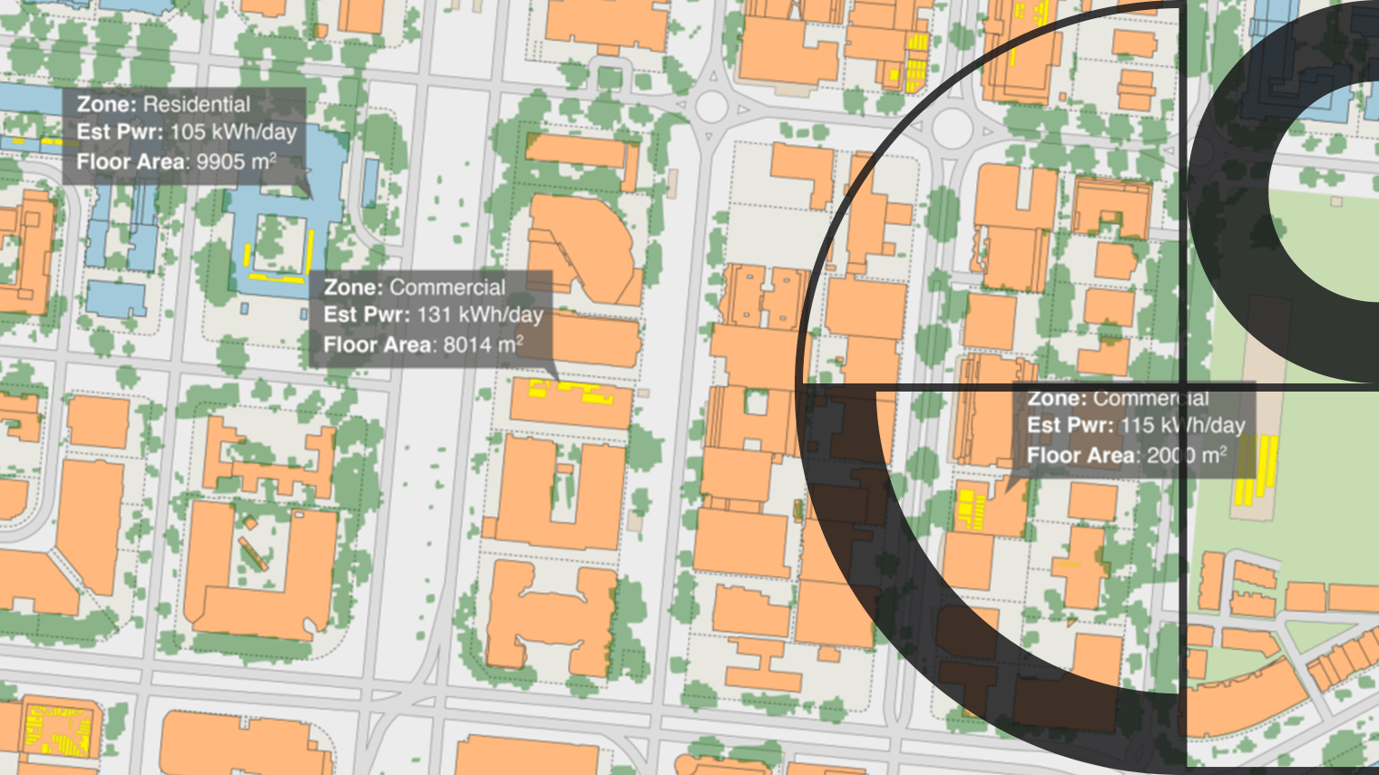
Geoscape Buildings data includes comprehensive attributes such as floor area, building heights, roof type, land zoning, and indicators for solar panels and swimming pools.

Flexible applications
The data is used in various applications, including insurance risk analytics, emergency response management, urban planning, acoustic modeling, and research studies.
Custom Insights
Customise the data with enriched insights

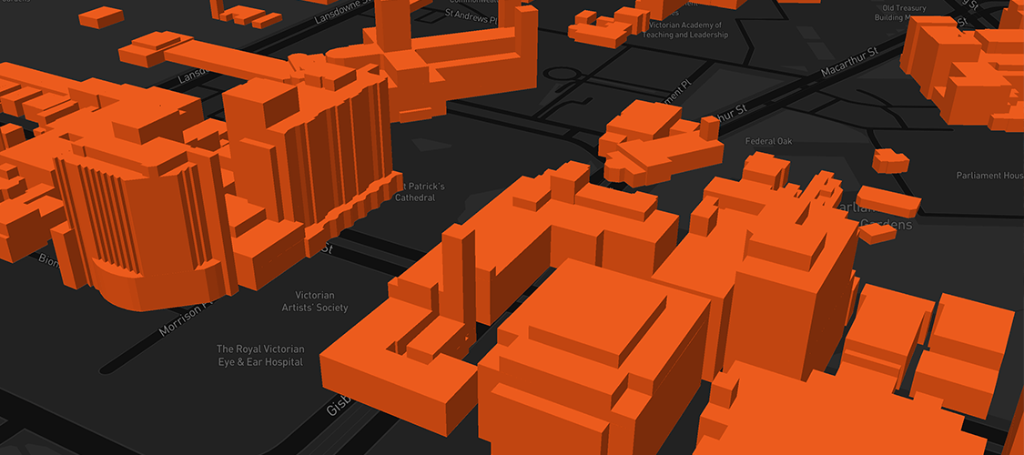
BuildingsHD
Improved level of detail 3D building models enable accurate analysis, better presentation, and precise calculation
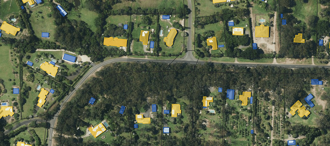
Main building flag
Identification of the main building or primary residence of the land parcel
Using Geoscape Buildings
Insurance
Enhances risk analytics, giving insurers better confidence in setting premiums that reflect actual risks.
Emergency response management
Use building data to coordinate response to unfolding simulate disasters like floods or bushfires and predict their impact on people and properties.
Urban planning
3D building data supports the creation of visualisations for new developments, showing how they fit into local areas.
PropTech
Building data includes location, linked addresses, planning zones, road access, and features like solar panels and swimming pools, simplifying site selection.
Acoustic modelling
Acoustic engineering companies use Geoscape Buildings data to create noise models that aid in planning construction projects.
Research studies
Researchers can use Geoscape Buildings data to explore how affordable housing and its surrounding environment affect health, lifestyle activities, and cognitive health.
Impact Stories
Real world success stories of this product
Geoscape Data Boosts SLR’s Noise Modelling Capabilities
Geoscape data enhances precision and efficiency in noise assessments

WindTech Streamlines Wind Modelling with Geoscape Data
How WindTech Reduces Project Time with Geoscape Data
Geoscape Australia Enhances Bushfire Resilience
How Geoscape powers a Bushfire Resilience app
Leveraging Property Intelligence for a Net Zero Future
Achieving global Net Zero carbon emissions relies on organised and dependable data.


Some images on this webpage were created using aerial imagery © Aerometrex Ltd.