Key Features

Comprehensive property information
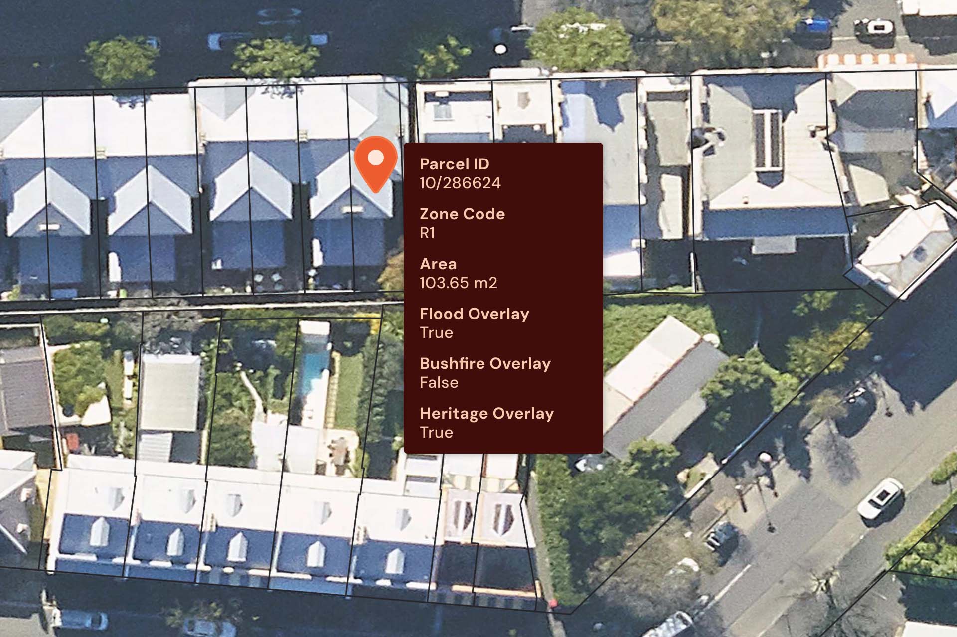
Offers detailed data on land parcels, including boundaries, addresses, and development potential.

Integrated land insights
Delivers a harmonised national dataset that combines key land information, removing the need for separate data handling and maintenance.

Diverse data
Describes a broad set of surface cover classes including Built-up Areas, Bare Earth, Urban Trees and Greenspace.

Linkages to G-NAF and State Records
Integrate your records with G-NAF and state government records, enabling efficient workflows and spatial management of your property portfolio by linking directly to relevant land parcels.
Custom Insights
Customise the data with enriched insights
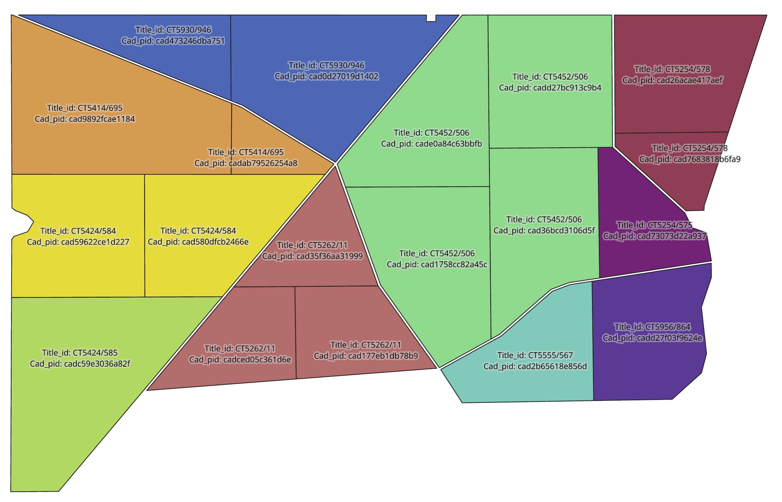
Title Particulars
A single title of land may be made up of many cadastre land parcels. Spatially enable your portfolios by matching your customers’ title information to cadastre land parcels.
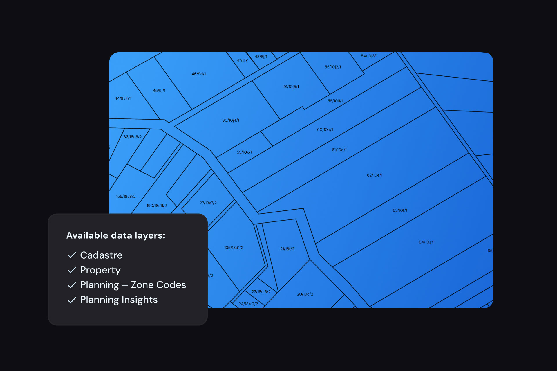
Datasets available
Using National Land Parcels
Urban design and planning
Use detailed zoning information to guide site selection and research the viability and impact of proposed developments.
Real estate
Link property sales data with land parcels to track transactions, understand attributes, and identify market trends.
Analytics
Combine National Cadastre, Planning, and Property for spatial analytics, site selection, and analysing Census data and regional development.
Government
Use planning information to model potential population, housing, and industry growth and its national impacts.
Site management
Assess site specifics before starting works, understanding boundaries, structural complexities, and necessary information on usage and restrictions.
Impact Stories
Real world success stories of this product

Improving Customer Experience at Before You Dig Australia
How Geoscape’s Address Verification enhances BYDA’s safe digging application process

Some images on this webpage were created using aerial imagery © Aerometrex Ltd.