Key Features

Comprehensive data products
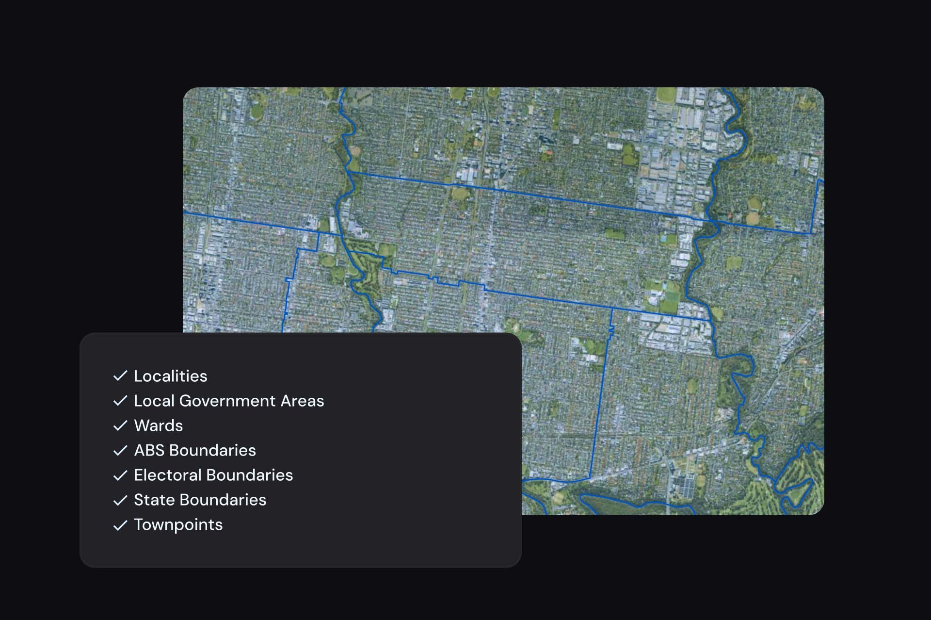
Seven distinct datasets including National Localities, LGAs, Wards, ABS Boundaries, Electoral Boundaries, State Boundaries, and Townpoints.

Integration capabilities
Can be used individually or integrated with demographic or built environment data for enhanced analysis. Integrations include G-NAF, cadastre, buildings and historical archives.

Foundational data
These datasets underpin Australia’s data requirements, providing the essential location context needed for robust analysis.

Regular updates
ABS Boundaries are updated every five years to coincide with Census data releases. Localities receive quarterly updates.
Datasets available
Using National Administrative Boundaries
Emergency and Risk Management
Identify and assess areas that are under threat to understand the potential impact on local populations and assets, enhancing emergency response planning.
Profiling
Integrate diverse data to create detailed area profiles, aiding in trend analysis like solar adoption.
Policymaking
Inform policy development and track the effectiveness of policy implementation.

Impact Stories
Real world success stories of this product

Improving Customer Experience at Before You Dig Australia
How Geoscape’s Address Verification enhances BYDA’s safe digging application process
Enhancing the ABS Census with Geoscape Addresses
The Australian Bureau of Statistics leveraged Geoscape solutions to streamline form completion and ensure data accuracy in the ABS Census.
