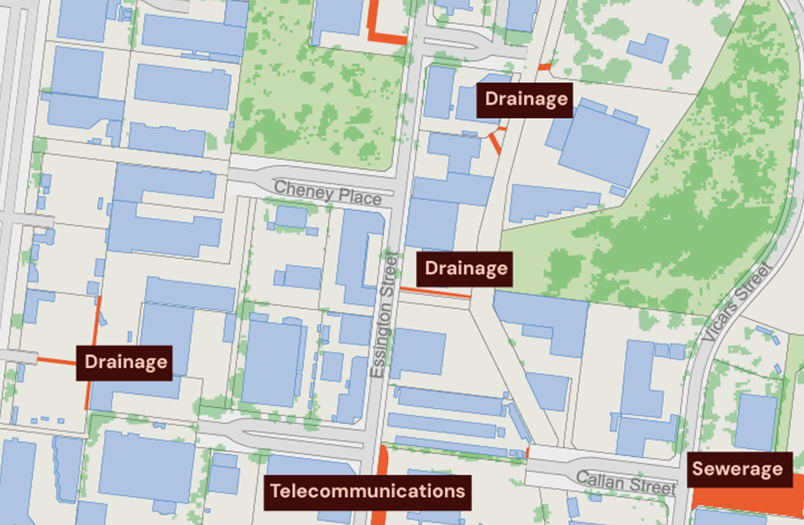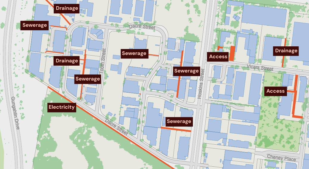
What are Easement insights?
Easements are legal rights that let others use or access a property for specific purposes, such as installing utility infrastructure, managing drainage, or providing access routes.
Geoscape provides a government-sourced digital map of land rights in Australia, showing the location, size, and type of easements and linking them to official land boundaries in Geoscape Cadastre.
This dataset helps stakeholders understand how easements affect land use, development potential, and property value.
How can Easements data be used?

Infrastructure and network planning
Utilities and Telecom companies can use easement data to identify areas with existing restrictions, for smoother infrastructure planning and maintenance.
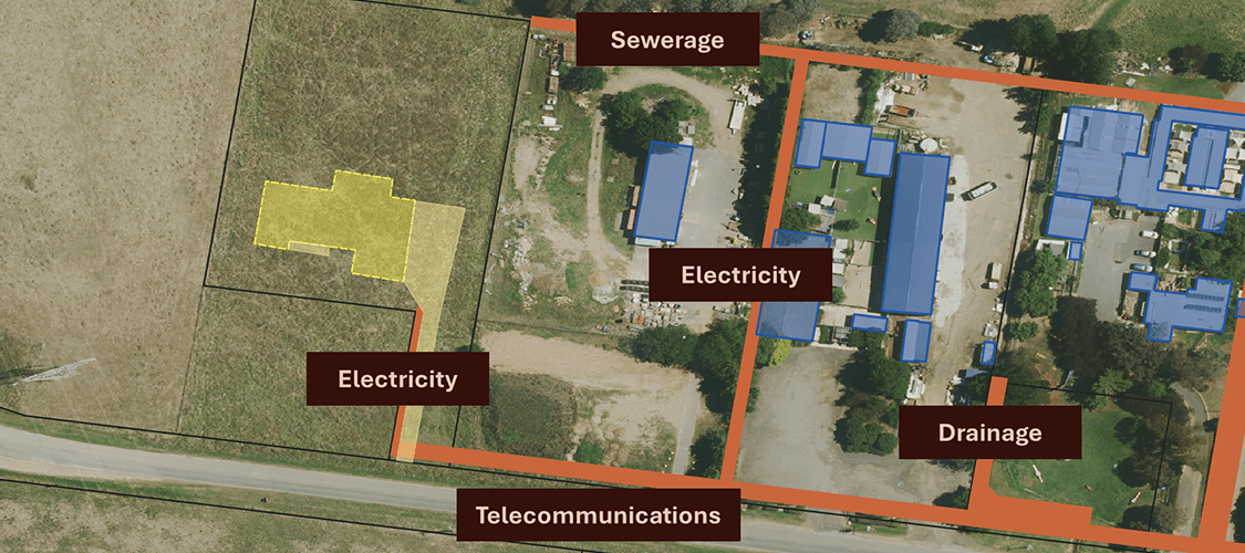
Property development potential and valuation
Developers can identify land use restrictions and potential issues, allowing for more accurate property valuation and informed decision-making during planning and acquisition.

Project planning and site selection
Developers can incorporate easement data into due diligence to spot potential restrictions early, leading to more effective project planning.
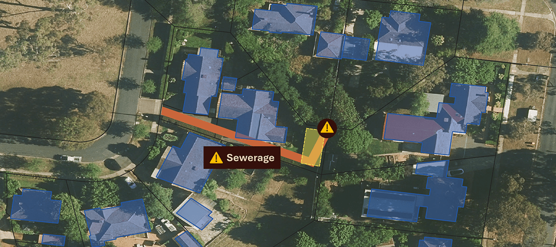
Cost and time savings
By using easement data, companies can prevent expensive legal issues and construction delays related to land use conflicts.