How Much Do Dark Roofs Affect the Urban Heat Island?

Geoscape Buildings has the attribution to estimate Solar Reflectance Index

Published 23 Nov, 2021

urban heat island effect

Solar Reflectance Index (SRI) is a key measure in estimating the Urban Heat Island effect.

Attribution available in Geoscape Buildings 3.0 can be used to calculate SRI and show how much dark roofs affect the Urban Heat Island.

The NSW planning minister Rob Stokes has foreshadowed a change in policy to ban dark roofs as part of the State’s efforts to reach net zero emissions targets by 2050.

“This would have an enormous impact on the urban heat island effect in our city” the minister said.

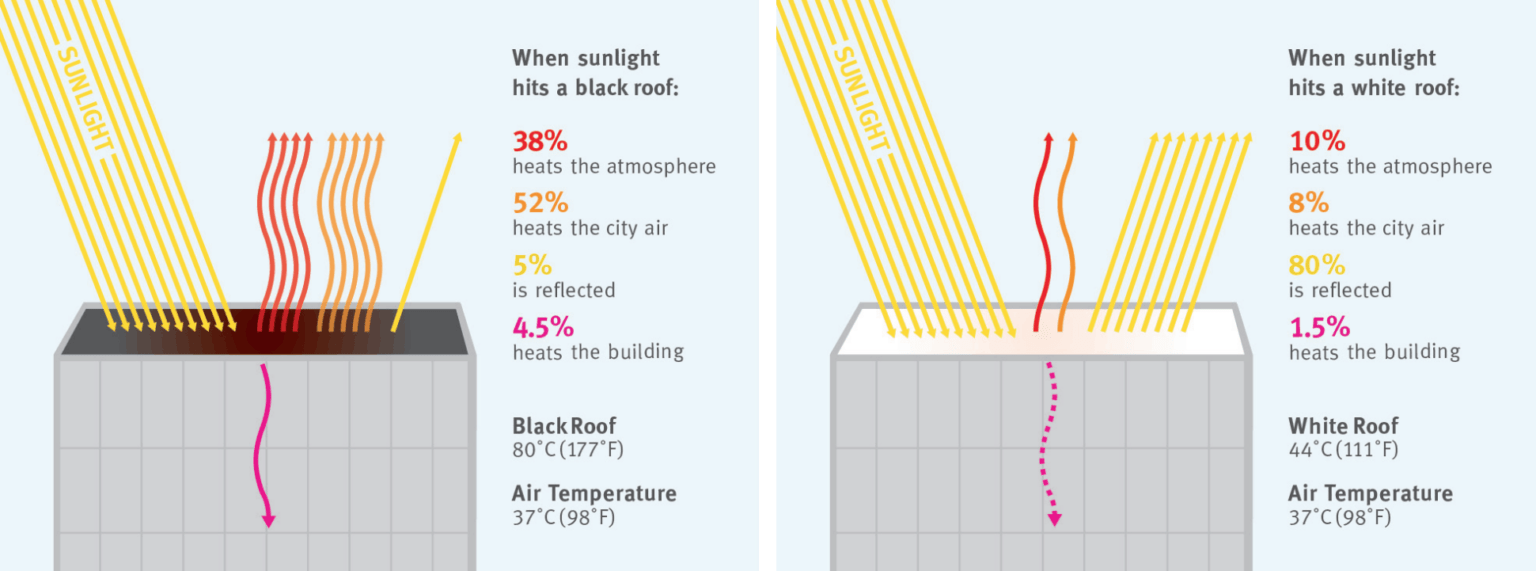
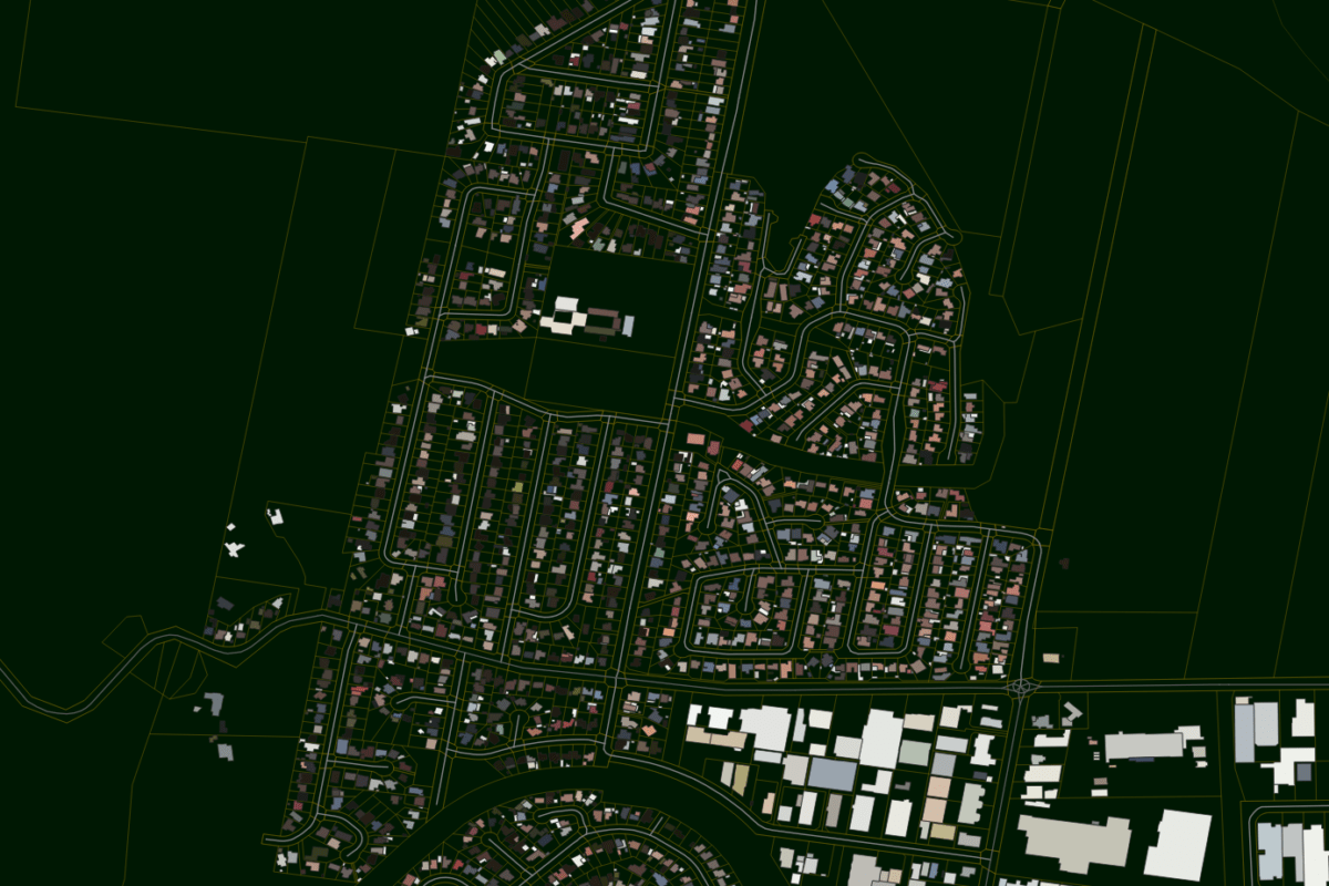
Buildings, and their roof construction are a significant contributing factor to the Urban Heat Island Effect. The Geoscape Buildings 3.0 dataset contains attribution for both roof_colour and primary_roof_material.

These values can be used to estimate Solar Reflectance (how much solar radiation a roof reflects vs absorbs) and Emissivity (how quickly, the roof radiates energy) two key values used to estimate an overall Solar Reflective Index of a roof.
image
Image source: www.c40knowledgehub.org

The Solar Reflective Index (SRI) is a calculated value between 0 (low reflectance and low emittance) and 100 (high reflectance and high emittance).

The complex calculation for SRI places a higher importance on the reflectance of an object. In practice, it is difficult to change the emittance of materials, however changing the reflectance can be as simple as selecting a lighter colour roof.

image
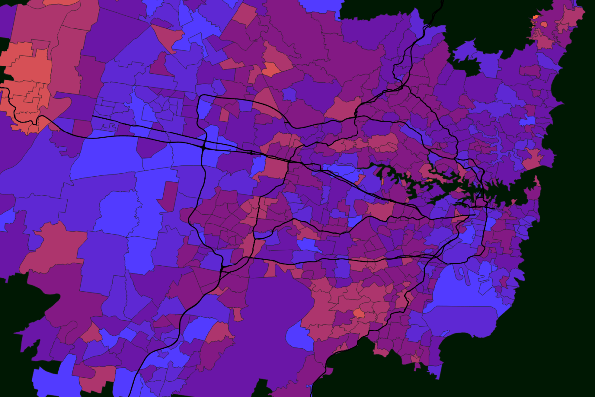
Aggregating SRI values by suburb based on building area shows the Sydney suburb of Camperdown has roofs are hotter than surrounding suburbs
image

SRI values can be aggregated using the building_area attribute (also included in the Geoscape Buildings 3.0 dataset) to get an idea of which suburbs have hotter roofs and which suburbs have cooler ones.

More accurate measurements can be obtained for each individual roof however they require specialist equipment, analysis of each plane of the roof’s surface with respect to angle and aspect, and considerations for material thickness, density, surface finish and the age of the surface.

Aggregating the data can give an overall indication of roof SRI for a large collection of buildings. Suburbs provide a sensible area to group and average SRI values over with consideration to building and suburb area.

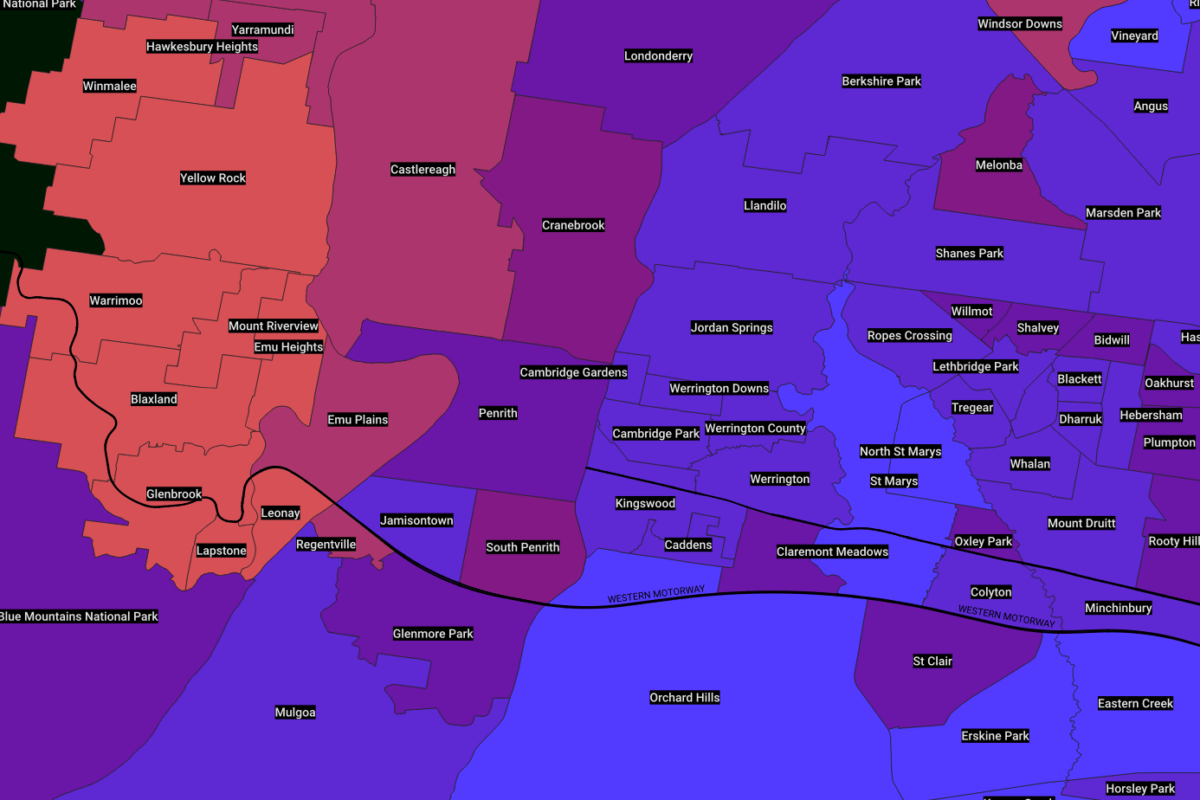
We calculated the average roof SRI for most suburbs in Greater Sydney and found that some of the suburbs in Sydney’s West have substantially hotter roofs than some others.

image
Aggregated SRI for Sydney suburbs
image
Aggregated SRI for Western Sydney Suburbs
image
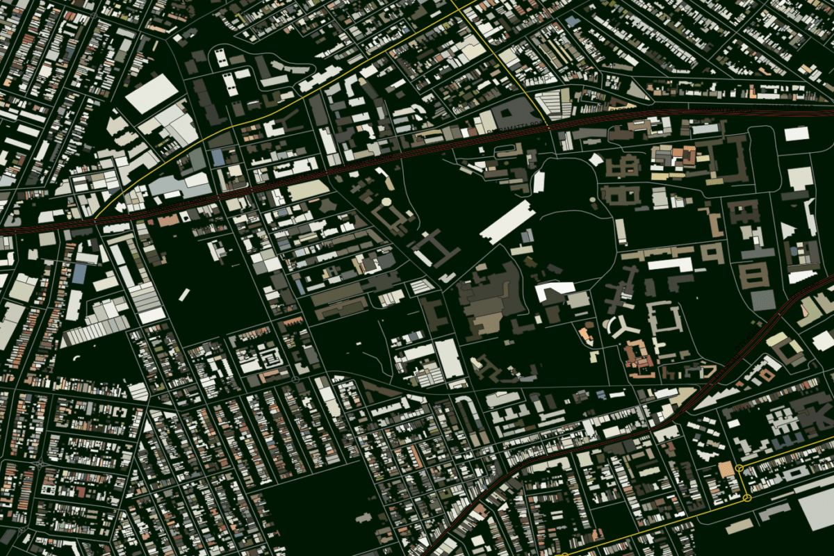
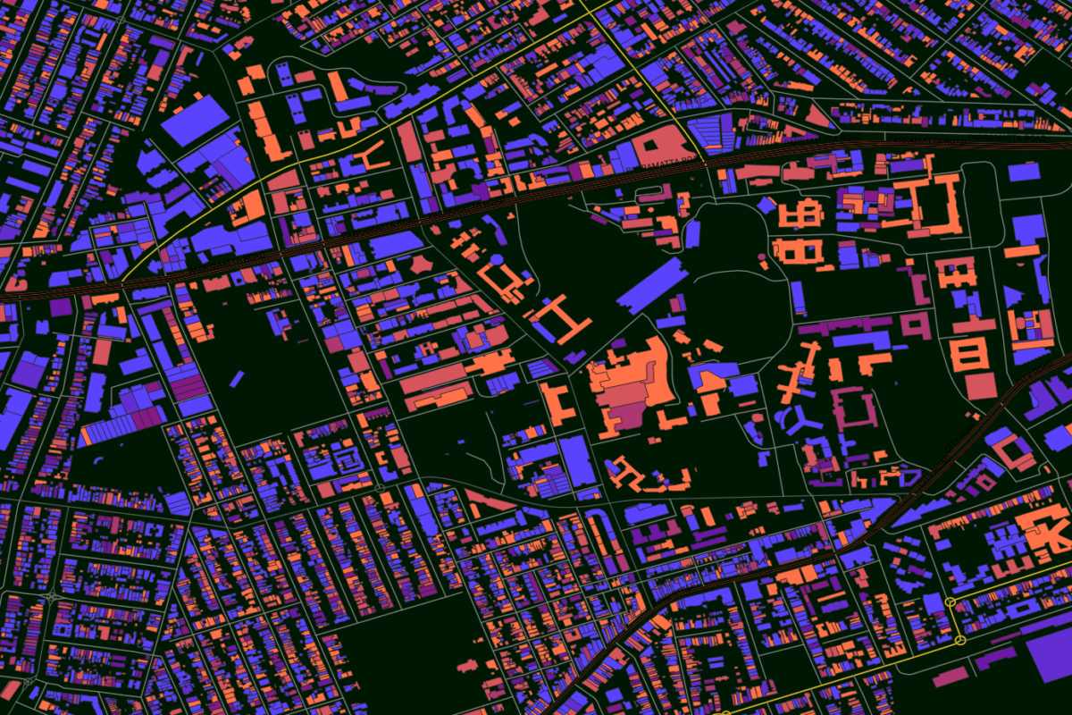
Colour based on roof_colour attribute

Western Sydney suburbs have significantly higher aggregated roof SRI values. A selected area of Emu Heights clearly shows the impact of roof colour on the calculated roof SRI.

Many factors contribute to the Urban Heat Island effect in both a positive and negative manner such as tree coverage, surface cover, water bodies, green space, climatic factors and localised topography.

Geoscape has a number of other regularly published datasets that cover these attributes. Stay tuned for further articles analysing how our data can help you to analyse the Urban Heat Island and also a deeper dive into the technicalities of how we calculated SRI.

Author: Andrew Collins, Pre-sales Engineer, Geoscape Australia

Custom solutions

Our expert team can enhance and enrich Geoscape’s datasets to meet your organisation’s needs

Talk to us