Geoscape’s Journey to First Floor Elevation
How Geoscape is advancing property-level flood intelligence in Australia
The Flood Modelling Gap at a Property Level
Understanding the built environment of Australia is critical to informed decision making on enhancing resilience to flood. Yet flood risk modelling is commonly undertaken either at an aggregated level (for example, postcode level) or using address locations without context of individual properties’ resilience.
Since Geoscape released National Buildings in 2016, our users have improved their peril models by using precise building locations to better understand the likelihood of flooding at a property.
While this has significantly enhanced the accuracy of property-level risk assessments, location alone does not explain how flood waters will affect an individual building.
Why First Floor Elevation Matters
A key data gap in flood modelling is the height of a building’s first habitable floor above ground. When this floor sits above flood waters, the damage experienced at a property can be significantly reduced.
At Geoscape Australia, we have been investigating how this information can be collected accurately and at a national scale. This work led to the development of our First Floor Elevation (FFE) capability in partnership with GeoX AI. GeoX AI specialise in extracting built environment insights from aerial and street imagery and partner with us for our Buildings, Solar, and Tree products.
FFE measures how high a building’s first habitable floor sits above ground by analysing street-level imagery collected from vehicles, focusing on the position of the main entrance and features such as stairs and windows, and their relationship to the entrance.
Localising FFE for Australian Building Types
Using algorithms developed for overseas environments often require adaptation for Australian building styles. Drawing on experience from our Buildings product, we have built up significant experience in localising globally leading capabilities to excel in Australia.
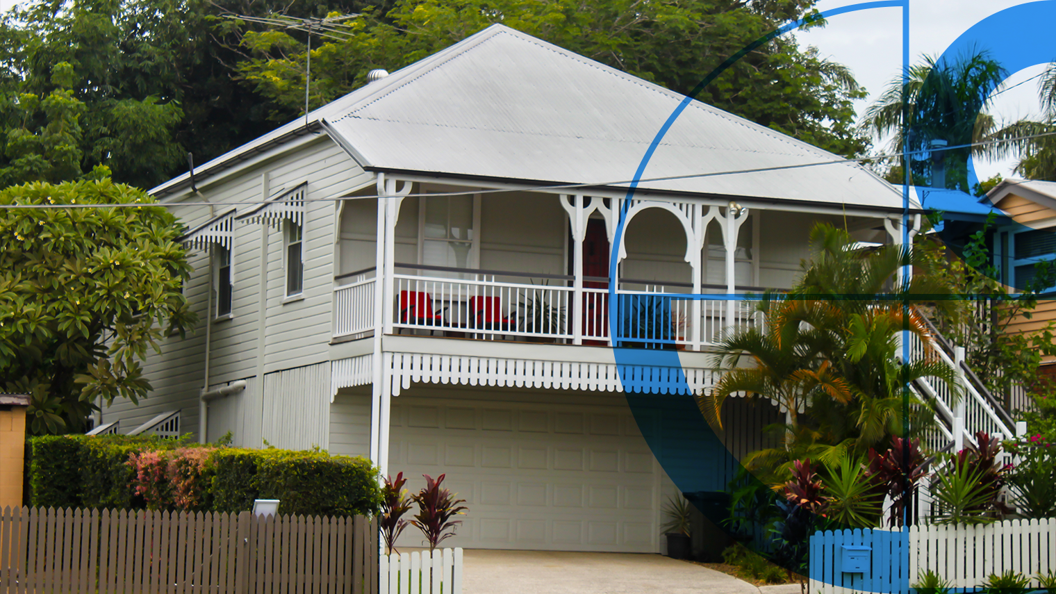
Australia has mostly similar architectural styles to locations where the algorithms were developed and deployed (the US and Japan) achieving similar accuracy levels with minimal intervention. However the algorithms quality was found to be significantly reduced for more unique Australian styles including Queenslander properties, which is impactful given the raised nature of these, and their prevalence across flood risk areas of our north-eastern coastal regions.
A Queenslander-style home with its characteristic elevated floor.
Building on GeoX AI’s proven models, we adapted the approach for the Australian market using Geoscape’s ground-truth data. This helped calibrate the models for local building styles and ensured the final dataset achieved accuracy consistent with international results.
Ground Truthing and Field Validation
To understand the performance of the algorithm and assess next steps to enhance this, we undertook field capture sending our team out to manually measure hundreds of homes across different locations, styles, and heights above ground.
This ground truthing exercise compared our manual measurements with the FFE model results and confirmed that:
- The FFE process was working well for properties on or near ground level capturing these consistently within target accuracies.
- Raised properties were frequently under measured.
- Ambiguous properties including those with multiple entrances, or where the entrance is obscured were inconsistent in their results.
Throughout this validation process, FFE data was used to support responses to several flood events across Australia. Feedback from government agencies involved in these responses was critical in guiding further quality improvements.
Iterative Model Improvement
The second round of algorithm training was focused on ensuring measurements of raised properties were significantly closer to the real world value, especially Queenslanders that were commonly being under measured.
This round of development significantly improved accuracy for buildings identified as raised. However, some buildings were still misclassified due to uncertainty around the level of the habitable floor.
Handling Ambiguous and Complex Properties
The third round of training then focused on consistent approaches to ambiguous properties:
- Raised entrance with fully enclosed lower area (windows visible): Measure FFE to the main entrance door.
- Set Basement = Yes to capture the enclosed lower level that may be usable (habitable or storage).
- Garage dominates the lower frontage, no visible entrance or stairs: Classify the dwelling as on-ground with lower confidence.
- Set Garage = Yes.
- Space under the entrance is only partially enclosed: Measure FFE to the main entrance.
- Set Basement = No because the under-entry area is not fully enclosed.
- Raised main entrance plus a separate ground-level door:
- Measure FFE to the ground-level door and assign lower confidence, as it may connect to stairs leading up to a raised habitable floor.
Accuracy of measurements of raised properties improved for most complex or raised structures. Over time, a general model became an Australia-specific dataset with national consistency.
Measured Accuracy Improvements Across Iterations
| Iteration | FFE | Garage | Basement |
|---|---|---|---|
| V1 Overseas model deployed to Australia | 0.17 | Yes | Yes |
| V2 Focus on measurement precision of raised buildings | 1.85 | Yes | Yes |
| V3 Standardising raised building classification, confidence values, capture dates, and basement flag use. | 1.86 | Yes | No |
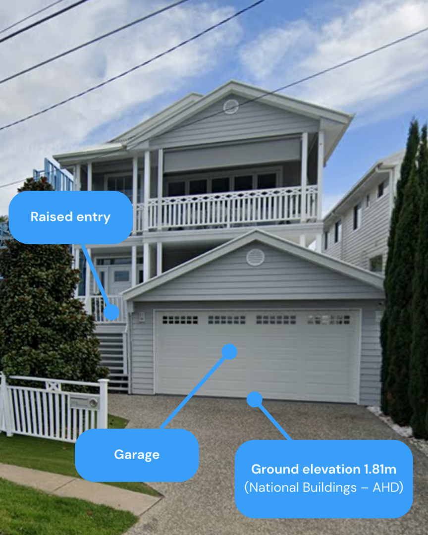
FFE manually measured as 1.9m above ground
This raised home illustrates the improvements made across FFE model versions. The first iteration significantly under‑estimated the first floor elevation at 0.17 m and incorrectly identified a basement, which was due to a windowed garage door.
Subsequent iterations corrected the basement misclassification and delivered FFE values of 1.85m and 1.86m, closely matching the manually measured elevation of 1.90m above ground.
This example shows how the refined model now accurately represents complex raised structures.
Validated and In Use
FFE fills a long-standing gap in flood risk modelling by adding information that location alone cannot provide. By measuring how high the first habitable floor sits above the ground, FFE improves understanding of how flood waters are likely to affect individual properties.
A major Australian financial institution has used FFE to review flood exposure and inform lending decisions on properties that were previously considered high risk. Insurers are using the data to refine pricing, better understand their portfolios, and plan mitigation actions.
Through multiple rounds of development, field validation, and use during real flood events, Geoscape in partnership with GeoX AI has built a nationally consistent First Floor Elevation dataset.
FFE now supports improved flood modelling, risk management, and planning across Australia.
