Geoscape Hub is designed for desktop use.
What is Geoscape Clip?
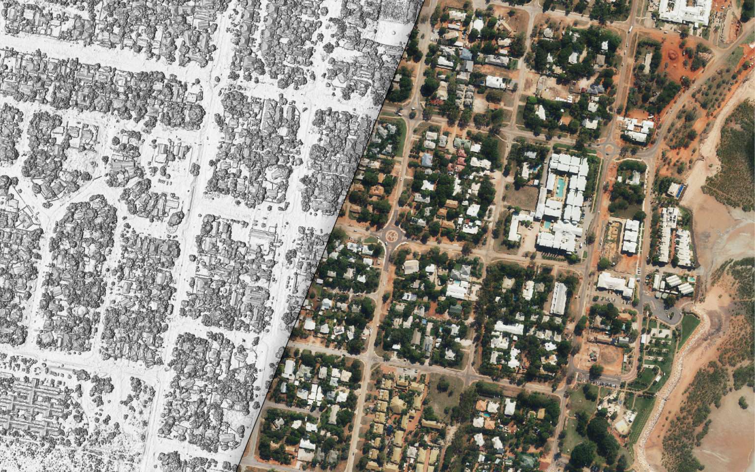
With clip, you can easily select and download Geoscape location data to support your environmental modelling, urban planning or site assessment. Datasets include G-NAF Addresses, National Buildings, National Solar, National Cadastre, National Planning, and more, available on demand and customisable to your chosen areas of interest.
Trusted data
Geoscape Clip is used by professionals in:
- Urban planning
- Environmental consulting
- Architecture, engineering & construction (AEC)
- Infrastructure & transport
- Government planning & policy
How it works:
Create your clip
Sign up for a free Geoscape Hub account, then create a new clip by drawing or uploading your project area.
Select datasets
Choose the datasets you need, name your project, and (optionally) include client references.
Get your data
Receive a free quote, review it, then purchase and download your datasets. Simple.
Challenges this solves

Trusted coverage
Get authoritative, up-to-date national data to build on a reliable foundation

Save time
Clip what you need instantly instead of digitising or hunting for open data

Cost control
Define project sites, assign costs to clients or cost centres, and avoid unnecessary spend

Fewer site visits
Access accurate property and built environment data remotely to cut down travel and save time
Products available in Geoscape Clip
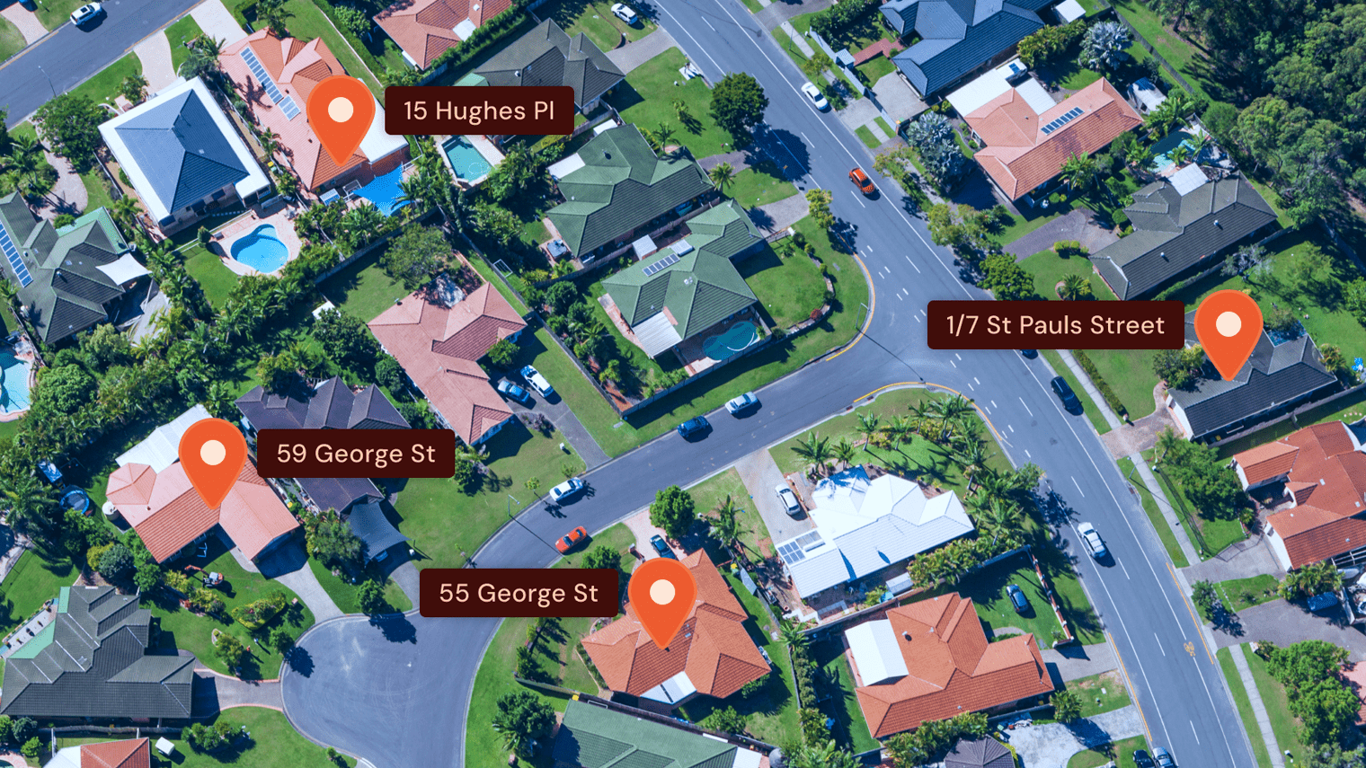
G-NAF
The trusted source of Australian addresses
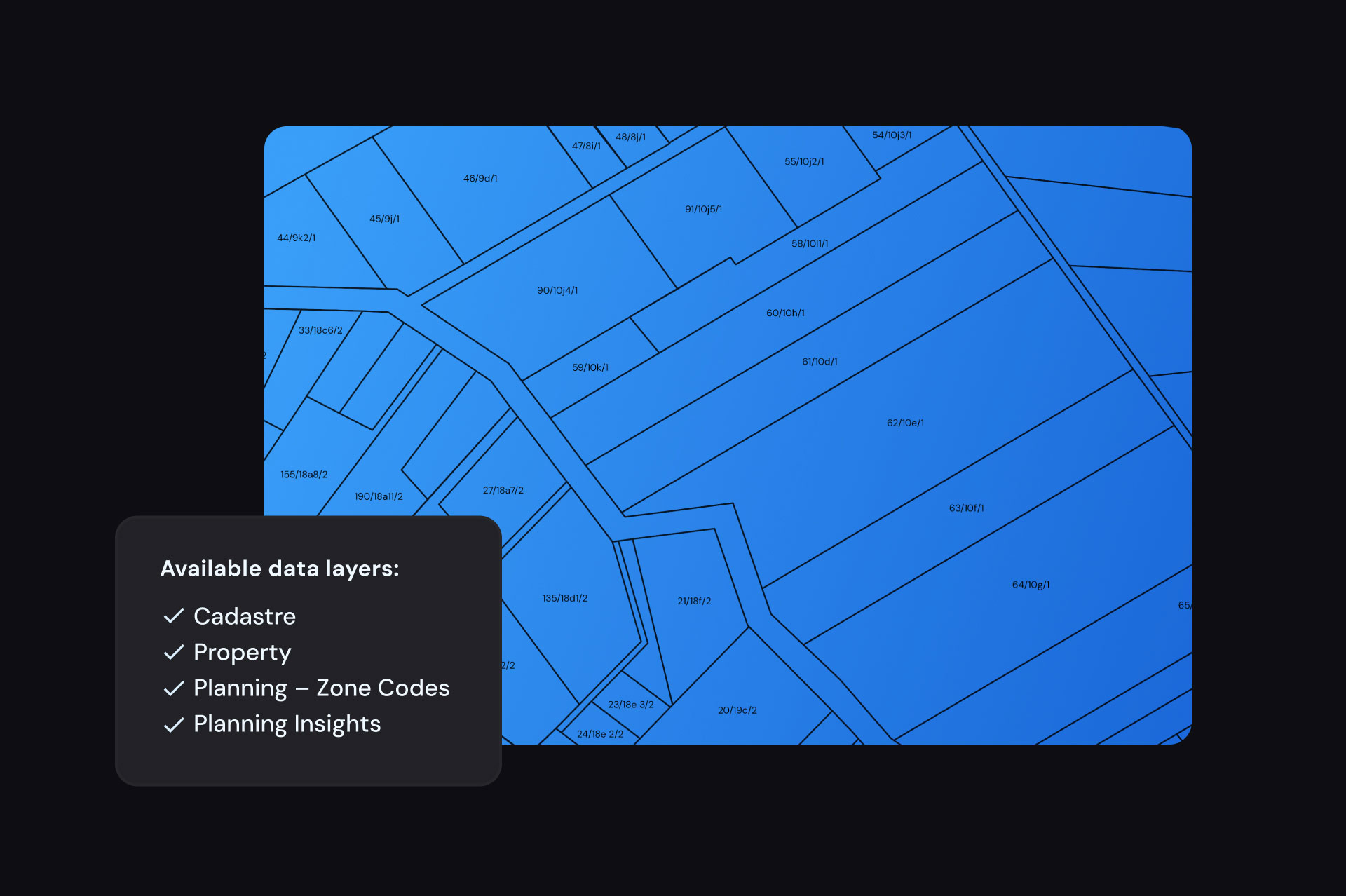
National Land Parcels
A complete picture of property in Australia
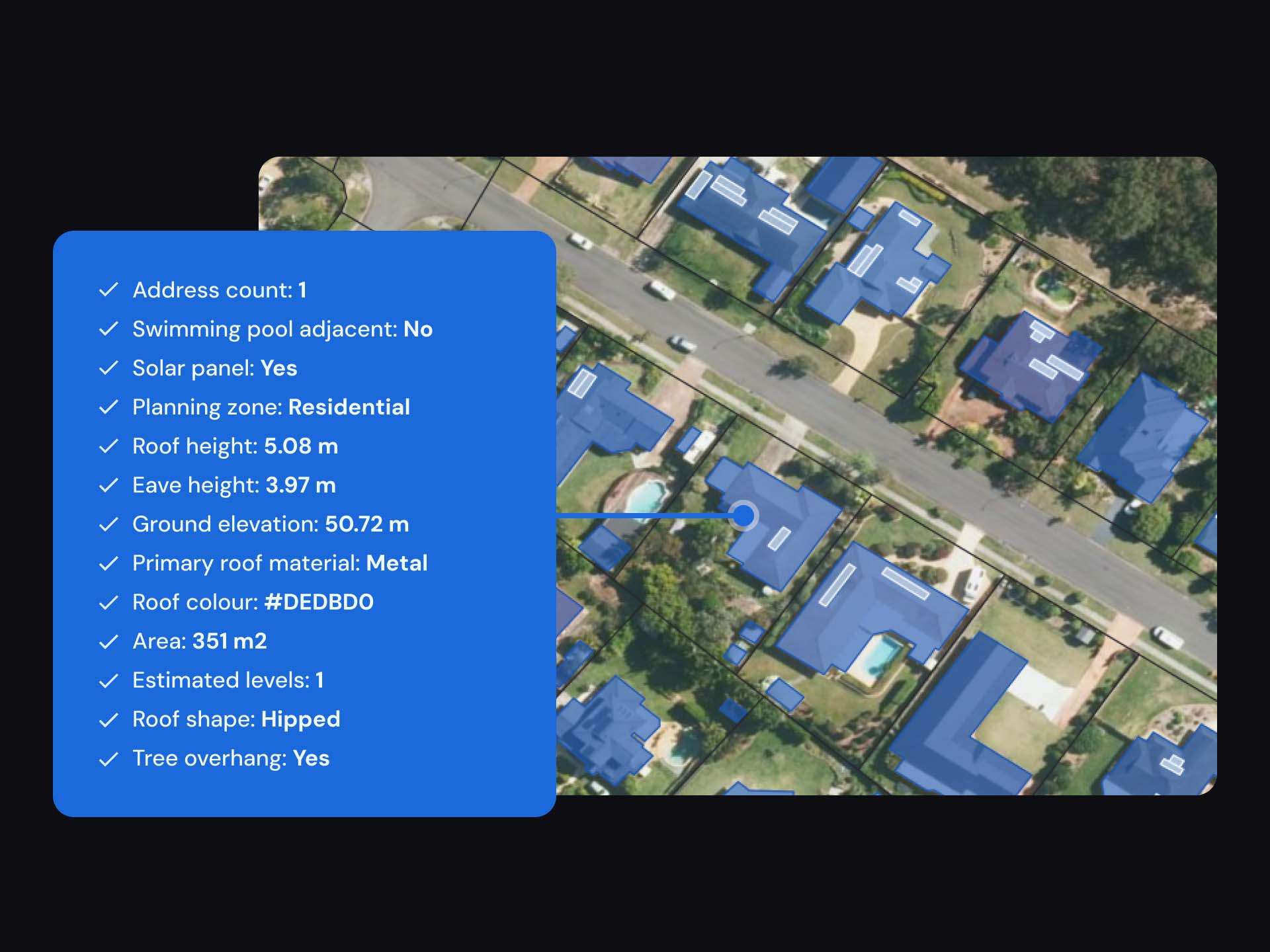
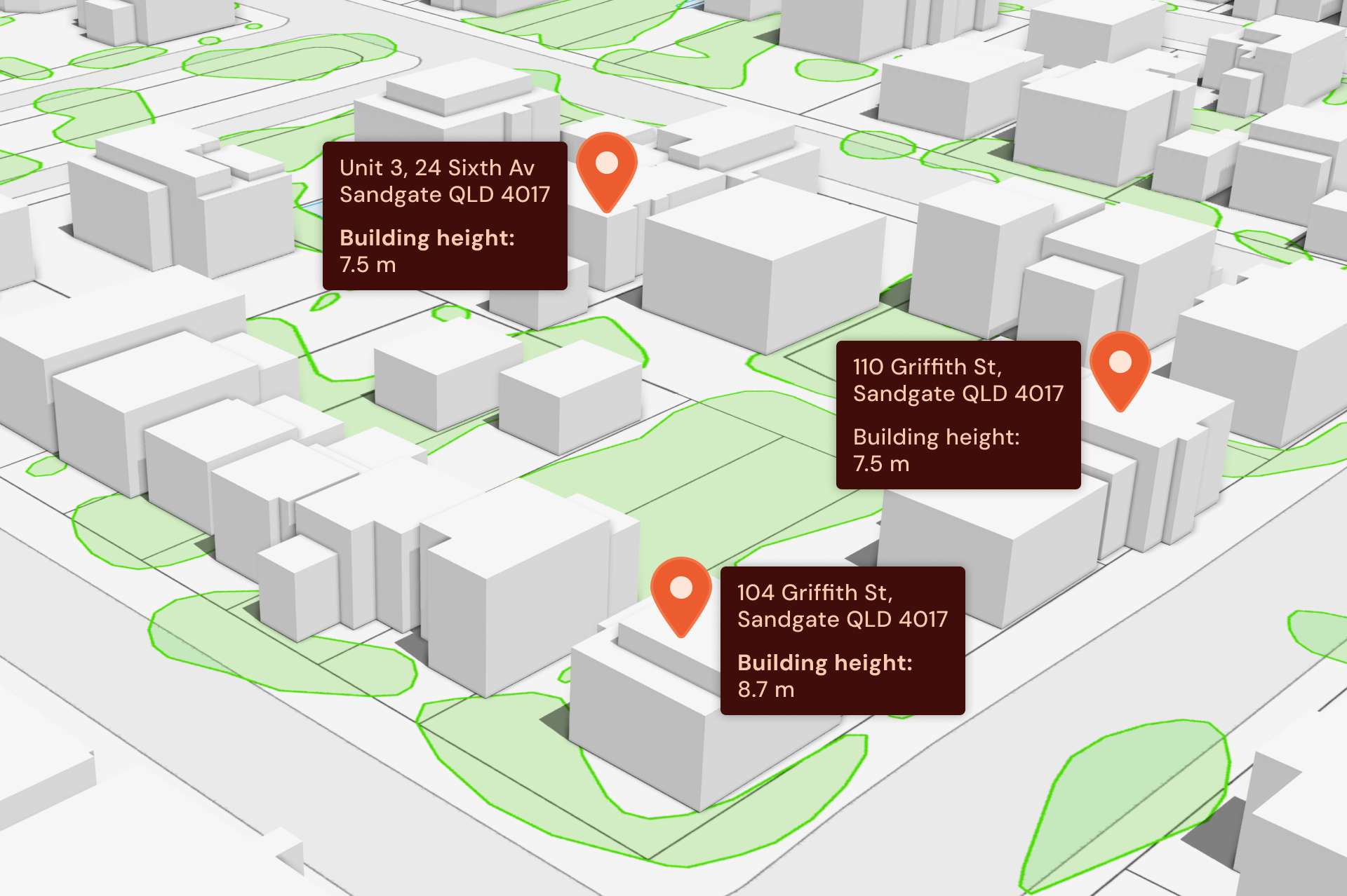
National Buildings
Insights on every building in Australia
National Admin Boundaries
Australia’s most comprehensive dataset of boundaries
Pricing
Free$0
$0 / monthly
For testing and evaluation
Get Free
Credits : 20,000
Overage per credit: N/A
Payment: N/A
|
Team$3,300 incl. GST / annually
$300 incl. GST / monthly
For small teams and access to premium data
Sign Up
Credits : 30,000 (monthly) and 360,000 (annual)
Overage per credit: $0.015 incl. GST
Payment: Credit Card and Invoice (Annually only)
|
Pro$11,000 incl. GST / annually
$1000 incl. GST / monthly
For growing businesses
Sign Up
Credits : 100,000 (monthly) and 1,200,000 (annual)
Overage per credit: $0.012 incl. GST
Payment: Credit Card and Invoice (Annually only)
|
EnterpriseCustom / annually
For large organisations
Contact Us
Credits: Contact Us for more details
Overage per credit: Contact Us for more details
Payment: Invoice
|
Credit Table
Dataset
Premium
Credit cost per feature
G-NAF Core
✕
2
National Localities
✕
2
National Local Government Areas
✕
2
National Wards
✕
2
National Building Footprints
✓
8
National Building Heights
✓
4
National Building Solar Indicator
✓
4
National Building Pool Indicator
✓
4
National Cadastre
✓
8
National Planning
✓
4
National Property
✓
8
Geoscape Hub is designed for desktop use.