How First Floor Elevation Is Reclassifying Flood Risk Across Australia
Geoscape’s First Floor Elevation data has identified 720,000 buildings assumed to be at flood risk as likely safe
* 47% AAL reduction is an estimation based on this study using a constant insured value with no spatial variation. ** 720,000 figure based on Geoscape flood overlay data, January 2026.
The problem: incomplete risk data
The government has committed to delivering 1.2 million new homes. Yet more than 3 million existing buildings are already in government-designated flood zones, raising serious questions about the sustainability of Australia’s housing stock.
Governments currently lack the data and insights to distinguish which of those 3 million buildings are truly at risk. For planning and insurance purposes, all are treated the same.
Treating all flood-zone buildings the same leads to higher insurance and reinsurance costs, reduced access to finance, lower property values, and weakened emergency response.
What this costs
- Higher insurance and reinsurance costs
- Reduced access to finance
- Lower property values
- Weakened emergency response
- Nearly half of Australia’s infrastructure buildings, including substations and power stations, sit in flood zones, threatening national resilience
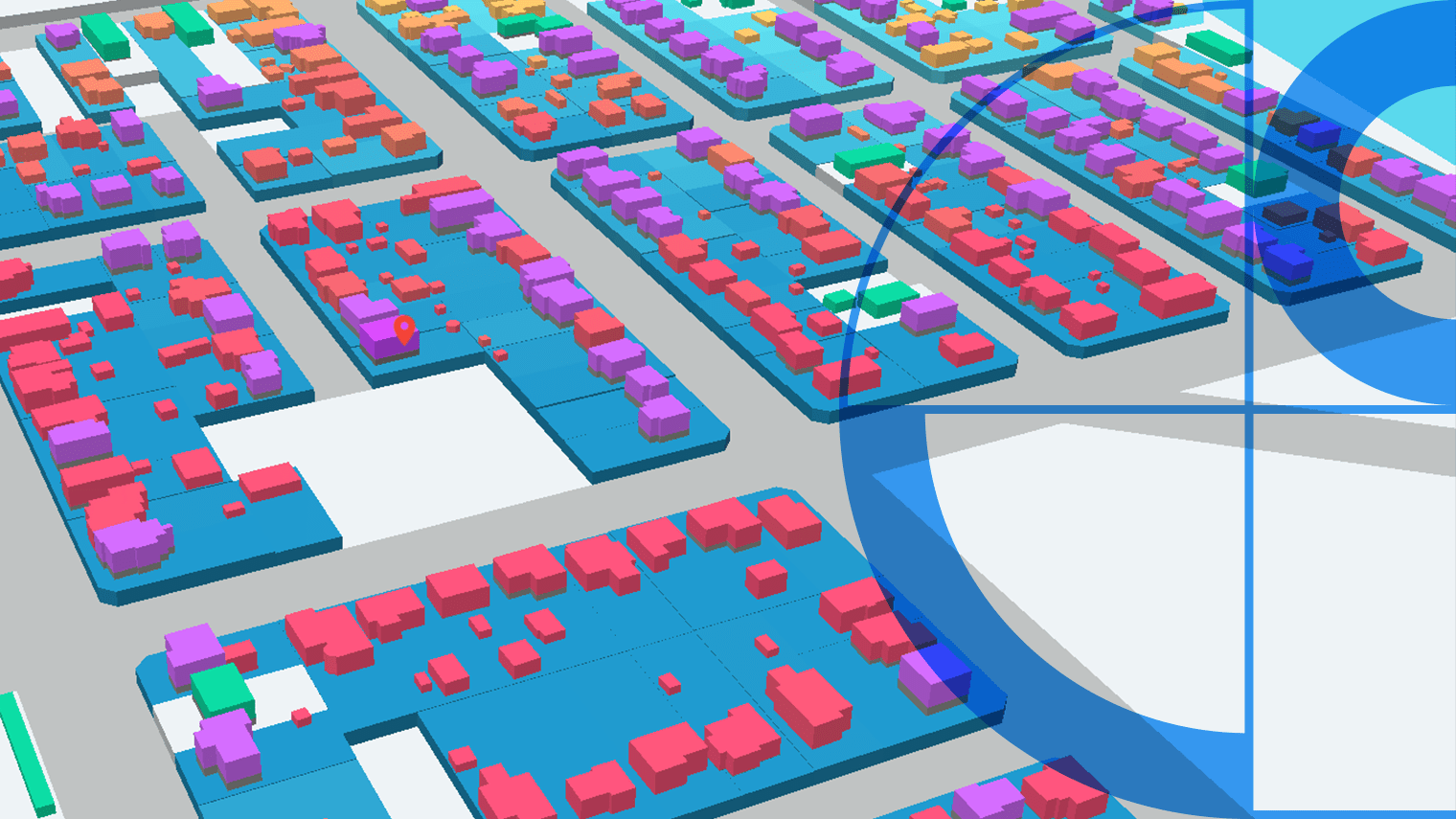
The solution: First Floor Elevation (FFE) Data
Geoscape Australia is enhancing the National Buildings Dataset with sophisticated First Floor Elevation Data. This provides precise insight into whether a building is susceptible to flood inundation by comparing the habitable ground floor elevation with local flood predictions.

Smarter underwriting
Precise flood loss assessment and property-level risk data enables sharper underwriting and fairer outcomes.

National scale
Building-level resilience data transforms flood risk from postcode averages to precision, across every region in Australia.

Better planning
Smarter, more informed planning and risk decisions, improved public safety, and better-targeted resilience and buy-back programs.

Insurance equity
More precise knowledge of building resilience enables fairer insurance and improved access to finance for at-risk properties.
Evidence-backed success: JBA’s modelling
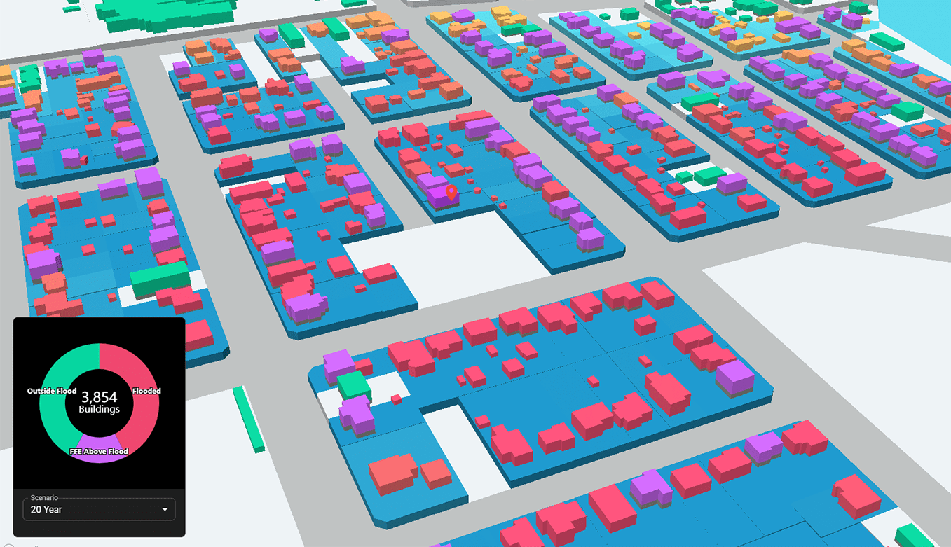
To validate FFE data at scale, Geoscape partnered with global flood risk experts JBA on a large-scale study of 571,000 flood-located buildings across Australia.
Australia’s most comprehensive FFE flood modelling exercise
The study demonstrates the power of FFE data: a 24% reduction in the number of ‘at risk’ properties due to higher ground floor elevations, and estimated average annual flood losses reduced by 47% due to reduced inundation. Nearly 720,000 buildings currently designated as ‘at risk’ are likely safe, based on their ground floor heights.
More precise knowledge of individual building resilience enables the de-averaging of flood risk, leading to a more precise understanding of which buildings are susceptible to flood inundation. For insurers, banks, planners, and emergency services, that distinction has real consequences for pricing, planning, and response.
From postcode averages to precision
The difference between postcode-level flood risk and address-level FFE data changes the conclusion for hundreds of thousands of Australian properties.
Incorporating FFE data into flood modelling provides enhanced precision for planners, insurers, banks, emergency services, and the communities that live in flood-adjacent areas.
Outcomes enabled
- Smarter, more informed planning and risk decisions at the local and national level
- Improved public safety and faster, better-targeted emergency response
- Fairer insurance pricing and greater access to finance for homeowners
- Sustainable housing development informed by real resilience data
- Stronger community and infrastructure resilience against future climate events
- A foundation for de-averaging flood risk across Australia’s entire building stock
Developed with GeoX Analytics