Geoscape location intelligence has significantly enhanced the Resilient Building Council‘s (RBC) Bushfire Resilience Home Self-assessment app. This free app bolsters bushfire resilience for Australian homes, leading to potential insurance savings and advancing sustainable community practices. The Bushfire Resilience Rating App Supported by a $3 million investment from the Albanese Government, the app provides a platform […]
Buildings
Case Study: Using Geoscape Data for Urban Renewal Research at UNSW
Introduction Max Di Rosario, a student at the University of New South Wales (UNSW), researched a significant urban housing challenge in New South Wales, Australia, as part of his honours thesis. The focus of his research is on the pressing need for revitalising aging apartment buildings within urban centres1, particularly in inner-city areas where the […]
The evolution of Geoscape Buildings
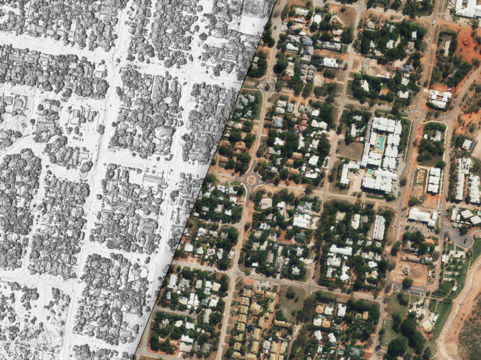
Geoscape Buildings has evolved significantly and now represents more than 16 million buildings in incredible detail. This blog looks at our journey to Geoscape Buildings 3.0.
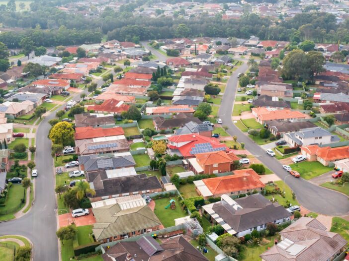
A comparative analysis of Sydney suburbs with Solar Photovoltaic roof panels
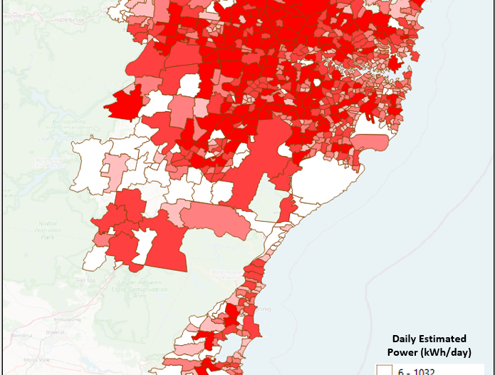
We used our Solar data to analyse solar installations, between 4 established and new suburbs of Sydney.
How much do dark roofs affect the Urban Heat Island?
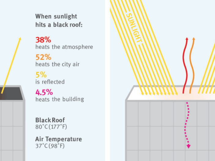
Solar Reflectance Index (SRI) is a key measure in estimating the Urban Heat Island effect. Attribution available in Geoscape Buildings 3.0 can be used to calculate SRI and show how much dark roofs affect the Urban Heat Island. The NSW planning minister Rob Stokes has foreshadowed a change in policy to ban dark roofs as […]
Geoscape Buildings and Urban Heat Islands | A tech deep dive
Can Geoscape Buildings be used to assist in managing the impacts of roof selection urban heat island effect? Check out this blog to learn more.