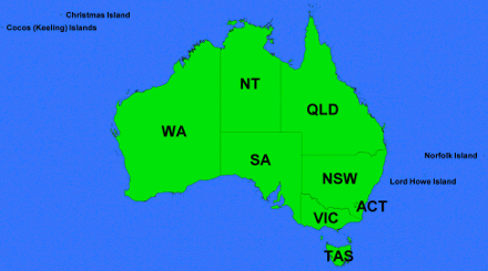
Administrative Boundaries
Metadata Statement
Metadata for the Metadata
- Metadata Identifier: Administrative Boundaries
- Scope: Administrative Boundaries Dataset
- Time: 18/08/2020
- Responsible Party:
- Contact Point: Michael Dixon
- Organisation: Geoscape Australia
- Position: Chief Data Officer
- Telephone: +61 2 6260 9000
- Delivery point: Unit 6, 113 Canberra Ave Griffith ACT 2603 Australia
- Access, Use, Security: Information supplied within the metadata may not be copied without referencing Geoscape Australia.
- Standard: ISO 19115-1 based on the ANZLIC/ICSM Metadata Working Group https://www.icsm.gov.au/sites/default/files/Poster%20-%20Best%20Practice%20for%20Datasets%20Metadata%20v1.pdf
- Language: English
Resource Metadata
- Title: Administrative Boundaries Dataset
- Identifier: Administrative Boundaries
- Abstract: The Administrative Boundaries dataset is comprised of seven products:
- Localities
- Local Government Areas (LGAs)
- Wards
- Australian Bureau of Statistics (ABS) Boundaries
- Electoral Boundaries
- State Boundaries
- Town Points
Data included in the various products are sourced from state, territory and Commonwealth governments with coverage specific to individual themes. Administrative boundaries are utilised to assist with government functions including the allocation of place names, managing elections, the delivery of local services and the collection of national statistics.
- Purpose: To create a single national point of access to Australian Administrative Boundary information.
- Time: Some themes within the Administrative Boundaries dataset were originally released prior to 2006. Since 2006 the dataset has been released quarterly and is published with updates quarterly in February, May, August, and November each year. New boundaries have been added in alignment with the timing of the Census in 2011, 2016 and 2021.
- Responsible Party:
- Contact Point: Geoscape Support
- Organisation: Geoscape Australia
- Telephone: +61 2 6260 9000
- Delivery point: Unit 6, 113 Canberra Ave Griffith ACT 2603 Australia
- Access, Use Security
- Legal Constraints: Administrative Boundaries is available under licence from the Australian Government through https://data.gov.au/. The dataset is also available under licence from Geoscape Australia and authorised partners. Data usage is in accordance with the Geoscape Copyright Notice and Disclaimer available https://geoscape.com.au/legal/data-copyright-and-disclaimer/
- Security Constraints: N/A
- Use Limitations: Administrative Boundaries are sourced from different governments with boundaries for different themes typically created under different legislation. For most themes, boundaries have not been created to align at borders or align across themes.
- Releasability: The dataset should only be distributed in accordance with the licence under which it has been accessed.
- Extents:
- Reference System:
- Spatial Reference System: GDA94 and GDA2020
- Temporal Reference System: Gregorian calendar
- Language: English
- Format: Spatial formats including ESRI Shapefile, MapInfo TAB, Oracle Data Pump, other formats may be available through distribution partners.
- Additional Information: A Product Description for each product is available from Geoscape Australia. Release Reports are made available at the time product updates are released.
- Linked Services & applications: Related products and services are available via www.geoscape.com.au Administrative Boundaries is also available via https://data.gov.au/
- Status: Complete
- Lineage: All spatial data is supplied by the jurisdictions (Commonwealth, States and Territories Governments) through various agencies. For each theme, the data is supplied by the appropriate agency as described below.
- ABS Boundaries themes: The ABS Boundaries data is sourced from the Australian Bureau of Statistics (ABS) and is part of their Australian Statistical Geography Standard (ASGS). The digital ABS main Structures Boundaries are updated every five years for each national Census. The ABS carry out the update process to these themes using a range of information including other Geoscape Australia national datasets.
- Electoral Boundaries theme: State and Territory boundaries are supplied by the respective jurisdiction. Commonwealth boundaries are sourced from the Australian Electoral Commission. Electoral boundaries may undergo a redistribution at timeframes and through processes outlined by the relevant Electoral Agency.
- Local Government Areas theme: The digital Local Government Areas are supplied by all state and the NT territory governments.
- Wards theme: Are supplied by the NT, SA, VIC, and WA governments,
- Suburbs/Localities theme: The digital Suburb/Locality boundaries and their legal identifiers have been derived from the cadastre data from each Australian state and territory jurisdiction.
- State Boundaries theme: The digital State boundaries and their legal identifiers have been derived mainly from the cadastre data from each state and territory jurisdiction.
- Town Points theme: The Town Points and their associated attributes are sourced from the ABS. Cadastral parcels sourced from the state and territory jurisdictions are used to assist with Town Point Alignment where appropriate. This theme is not currently maintained.
Data processing of Administrative Boundary themes typically consists of mapping contributor data into the national data structure and the management data quality issues. External Quality Assurance processes are used to check the structural integrity of the data before extracts in various formats are completed.
- Associated Resource: Further product documentation including a Product Description and a Release Report are published at the time of a dataset update.
- Maintenance: The Administrative Boundaries dataset is updated quarterly although some themes inside the dataset may not be updated in every quarter.
- Storage: The Administrative Boundaries dataset is managed by Geoscape Australia.
- Distribution: The dataset is available from multiple locations
- From Geoscape Australia and authorised re-sellers;
- Organisation: Geoscape Australia
- Telephone: +61 02 6260 9000
- Mailing address: Unit 6, 113 Canberra Ave Griffith ACT 2603 Australia
- Authorised Resellers: Available via https://geoscape.com.au/partners/
- From the Australian Government
- https://data.gov.au/
- From Geoscape Australia and authorised re-sellers;
- Topic Category: Dataset metadata
- Keywords: Suburbs, Localities, Place Names, Local Government Areas, LGA, Council Boundaries, Shire Boundaries, State Electoral, Commonwealth Electoral, Federal Electoral, Electorate, Redistribution, Elections, Ward, Census Boundaries, Meshblock, ASGS, Town Point.