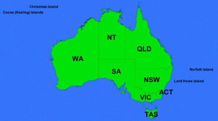
Postcode Boundaries
Metadata Statement
Metadata for the Metadata
- Metadata Identifier: Postcode Boundaries
- Scope: Postcode Boundaries Dataset
- Time: 21/09/2020
- Responsible Party:
- Contact Point: Michael Dixon
- Organisation: Geoscape Australia
- Position: Chief Data Officer
- Telephone: +61 2 6260 9000
- Delivery point: Unit 6, 113 Canberra Ave Griffith ACT 2603 Australia
- Access, Use, Security: Information supplied within the metadata may not be copied without referencing Geoscape Australia.
- Standard: ISO 19115-1 based on the ANZLIC/ICSM Metadata Working Group https://www.icsm.gov.au/sites/default/files/Poster%20-%20Best%20Practice%20for%20Datasets%20Metadata%20v1.pdf
- Language: English
Resource Metadata
- Title: Postcode Boundaries Dataset
- Identifier: Postcode Boundaries
- Abstract: The Postcode Boundaries Dataset provides a spatial representation of postcode information used by Australia Post to support their mail management and delivery operations. Postcodes are represented using both a polygon and point geometry.
- Purpose: To create a single national point of access to Australian Postcode Boundary information.
- Time: The Postcode Boundaries theme was first released in 2006. Since August 2007, the dataset has generally been updated quarterly in February, May, August and November each year.
- Responsible Party:
- Contact Point: Geoscape Support
- Organisation: Geoscape Australia
- Telephone: +61 2 6260 9000
- Delivery point: Unit 6, 113 Canberra Ave Griffith ACT 2603 Australia
- Access, Use Security :
- Legal Constraints: The dataset is available under licence from Geoscape Australia and authorised partners. Data usage is in accordance with the Geoscape Copyright Notice and Disclaimer available https://geoscape.com.au/legal/data-copyright-and-disclaimer/
- Security Constraints: N/A
- Use Limitations: Postcode Boundaries is produced through a partnership with Australia Post and provides the official representation of postal delivery areas across Australia. Australia Post operations included other postcodes such as those representing PO Boxes. These postcodes and their associated locations are not part of this resource.
- Releasability: The dataset should only be distributed in accordance with the licence under which it has been accessed.
- Extents:

West Bounding Longitude: +96 East Bounding Longitude: +168
- Reference System:
- Spatial Reference System: GDA94 and GDA2020
- Temporal Reference System: Gregorian calendar
- Language: English
- Format: Spatial formats including ESRI Shapefile, MapInfo TAB, Oracle Data Pump, other formats may be available through distribution partners.
- Additional Information: A Product Description for the dataset is available from Geoscape Australia. Release Reports are made available at the time product updates are released.
- Linked Services & applications: Related products and services are available via www.geoscape.com.au
- Status: Complete
- Lineage: The production process commences with textual matching between the Australia Post database and the attribute fields of the spatial Localities theme of the Administrative Boundaries dataset. Detailed analysis is then required of duplicate named Localities within VIC, NSW, and QLD to ensure that these Localities and their Postcode are neighboured to other Localities with the same Postcode. The next production stage involves the examination and allocation of Postcodes to gazetted Localities that either have no delivery service or have not yet been assigned a Postcode within the Australia Post database. This requires liaison with state-based Postcode controllers and in turn state-based delivery operations. This is an ongoing process and as a result, Postcode Boundaries will always be subject to change according to the needs of delivery operations. Locality boundaries are subsequently Dissolved/Aggregated based on the Postcode attribute.
- Associated Resource: Further product documentation including a Product Description and a Release Report are published at the time of a dataset update.
- Maintenance: The Postcode Boundaries dataset is updated quarterly.
- Storage: The Postcode Boundaries dataset is managed by Geoscape Australia.
- Distribution: The dataset is available from Geoscape Australia and authorised re-sellers.
- Organisation: Geoscape Australia
- Telephone: +61 02 6260 9000
- Mailing address: Unit 6, 113 Canberra Ave Griffith ACT 2603 Australia
- Authorised Resellers: Available via https://geoscape.com.au/partners/
- Topic Category: Dataset metadata
- Keywords: Postcodes, Postcode Boundaries, Post Code, ZIP, Delivery Area.