Enhance your council’s understanding of its built environment with Geoscape’s data.
Welcome to a new generation of accuracy and richness of built environment data. Enhance your council’s understanding of its built environment with Geoscape’s data.
Of the three government levels, local councils are the most connected to the intricacies of a location and its people, working hard to build thriving communities.
Geoscape’s accurate spatial information will provide your council with the ability to adopt digital transformation and use data-driven insight for better decisions in the planning and management of your council area, ensuring a better experience for your constituents.
Accurate digital models of Australia’s urban environments provide the foundation data for Digital Twin applications that better reflect the real world. Up-to-date built environment data allows a digitally-enabled council, assisting local government councils to provide vital services for their community, including:
Planning
Asset Management
Environmental Management
Regulatory Compliance
Emergency Management
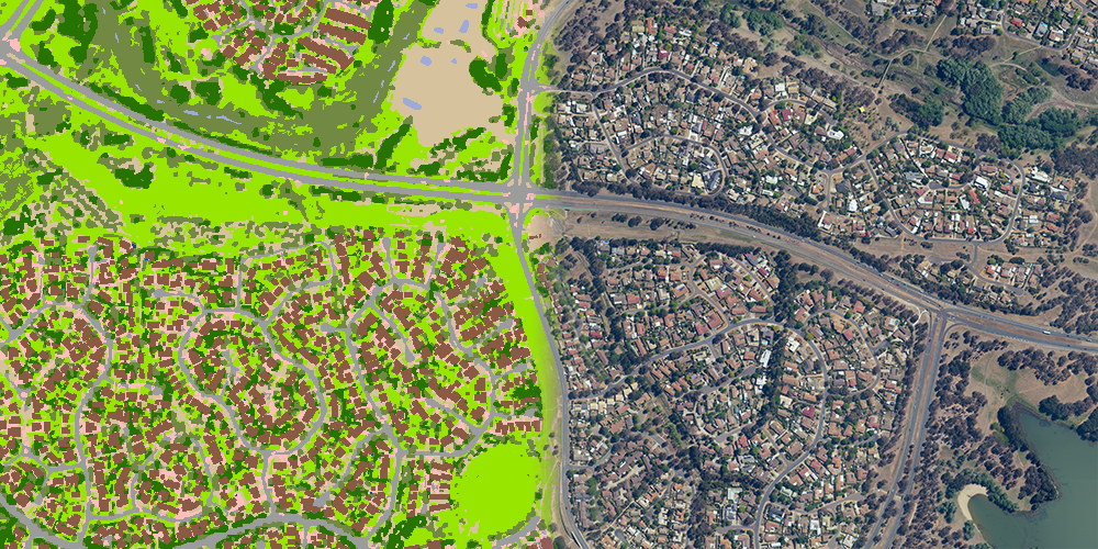
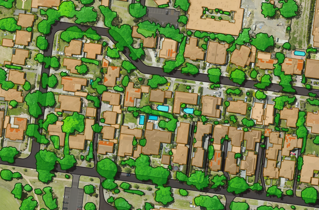
For decades Geoscape has been providing authoritative location data, utilising the latest technologies to continue improving our products. By partnering with industry leaders such as GeoX we use machine vision and deep learning technology, coupled with high resolution aerial imagery, to significantly evolve our digital model of Australia. This process has opened a new generation of accuracy and richness of built environment data.
Access accurate spatial information to inform your council.
Ask us how!
Planning
Utilise Geoscape’s Building, Tree Cover and Surface Features products to inform evidence-based strategic town planning.
- Review proposed changes to the city plan and infrastructure upgrades against development applications
- Value properties & sub-division of property parcels
- Influence water sensitive urban design
- Create 3D visualisations to assist planning decisions and public consultation engagement
- Rich data points to support decision-making for strategic planning
Asset Management
An easier way to keep track of everything in your LGA. Use Geoscape Buildings and Trees to map your asset locations, create maintenance programs, manage council contracts and monitor capital works.
Environmental Management
Urban heat islands, heat refuge, air quality, noise pollution, resource recovery, greening, drainage, and flood modelling are just some of the challenges councils face as part of their environmental management.
Geoscape’s urban trees, surface cover, building footprints and attributes – heights, presence of solar, and roof colour, are being used to model existing built and natural environments to help councils plan for these challenges, providing a more liveable environment for their residents and visitors.
Regulatory Compliance & Permits
Monitor compliance and help inform enforcement procedures for swimming pools, parking permits, and Land Use Planning permits based on the current built environment.
Emergency Management
Geoscape Buildings can help model a flood, bushfire or other disaster and anticipate the impact on people and property. It helps guide risk management, early warning systems, emergency response and post-event assessment.
Understand the precise location of buildings and their proximity to hazardous events such as storms, flood zones and bush fires to influence preventative initiatives.
Don’t just take our word for it.
We use location information in our onboard computing system in our ambulances to help crews navigate to the exact address and enable them to locate the emergency situation.
Steve Forbes, Assistant Director Spatial Services
– ACT Emergency Services
Location-based reporting is critical these days to monitor what is happening in the real world,” said Greg. “If you want to make sure the decisions you make are relevant to the community, you need the numbers and spatial information for what is happening on the ground.