Benefits for you and your customer
Empower data-driven business decisions
Forecast and respond to changing markets
Deliver better results by knowing what to remove than what to add
Save time and money
Deliver personalisation to your customers
Gain deeper customer and industry insight. Make better decisions
Assess and manage risks
Better data = Best results
Enabling better solutions
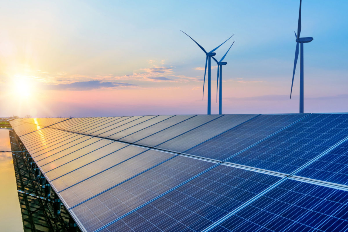
Environmental & social responsibility
Know your area–Better investments with location intelligence
With increasingly challenging and complex changes, from global health crises and environmental and climatological changes to economic inequalities, your organisation needs innovative strategies to navigate successfully.
Location data brings business intelligence that is key to increasing the impact of your social responsibilities, from addressing supply chain risks to creating a sustainable future for local and global communities.

Customer insights
Know your customer–Better planning with data-driven insight
Financial services providers have immense consumer data, from their purchasing history to credit card records but many organisations still find it near impossible to derive valuable insights from this data.
Locational intelligence makes it possible to understand the connection of customer behaviours to place, revealing valuable patterns and revenue opportunities that would have otherwise been missed.

Digital transformation
Know your experience–Better customer experience with personalisation
In a post-COVID world, organisations are seeking ways to improve customer experience by being more seamless and adding personalisation.
Location is integral to that. Using location intelligence combined with customer data, you can instantly respond to the changing consumer needs and market conditions and offer relevant content to every contact. With data-driven rules, you can understand how your customers interact.
Trusted by


Use Cases
Fire and flood risk modelling and analysis
With recent devastating floods and fire events across Australia, it’s important for banks to understand the property’s exposure and risk to such events. The combination of historical flood and fire footprints with data on today’s urban features can enable predictive risk models for areas not yet impacted by flood and fire events.
Understanding asset vulnerability can be informative for banks to understand their customer’s financial situation and risks.
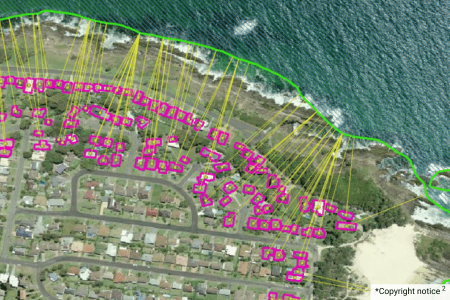
Coastal erosion and asset risk management analysis
Did you know there are about 50,075 buildings and over 117,000 addresses spread across 26 local government areas within 250m of the Pacific Coast? 70% of those buildings are within residential planning zones. Geoscape data can be used to understand coastal erosion risk and support the financial institution in understanding the risk profile for their customers’ assets.
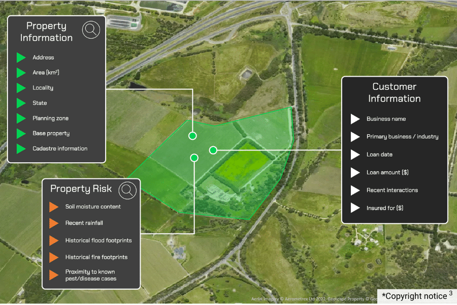
Vulnerability analysis of agricultural properties
Climate change can impact Australian farms in many ways. If banks can understand when their agricultural customers are likely to face financial hardship, they can engage with their customers with more information at hand.
Insights such as whether a customer’s farm is in a region of expected extreme seasonal conditions or if they are adjacent to a recent disease or pest outbreak become available to banks to inform their decision-making.
-

‘Making authentic data accessible and meaningful for all is our passion.’
– Dean Capobianco, CEO, Geoscape Australia
Understand your environments better, improve customer experiences and enhance organisational performance.
Interested to learn more. Talk to an expert
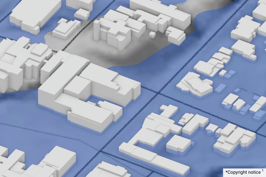
Copyright notice1 – Created using Geoscape Buildings and Geoscape Roads © Geoscape Australia 2022 Copyright and Disclaimer Notice, and 1m Digital Elevation Model data extracted 20 May 2022 © NSW Department of Customer Service licensed under the Creative Commons Attribution 3.0 Australia licence.
Copyright notice 2 – Created using aerial imagery © Aerometrex Ltd 2022, and Geoscape Buildings © Geoscape Australia 2022 Copyright and Disclaimer Notice.
Copyright notice 3 – Created using aerial imagery © Aerometrex Ltd 2022, and Geoscape Property © Geoscape Australia 2022 Copyright and Disclaimer Notice.
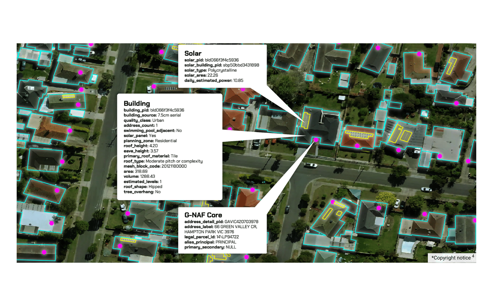
Copyright notice 4 – Created using aerial imagery © Aerometrex Ltd 2022, and Geoscape Buildings, Geoscape Solar and Geoscape G-NAF © Geoscape Australia 2022 Copyright and Disclaimer Notice.
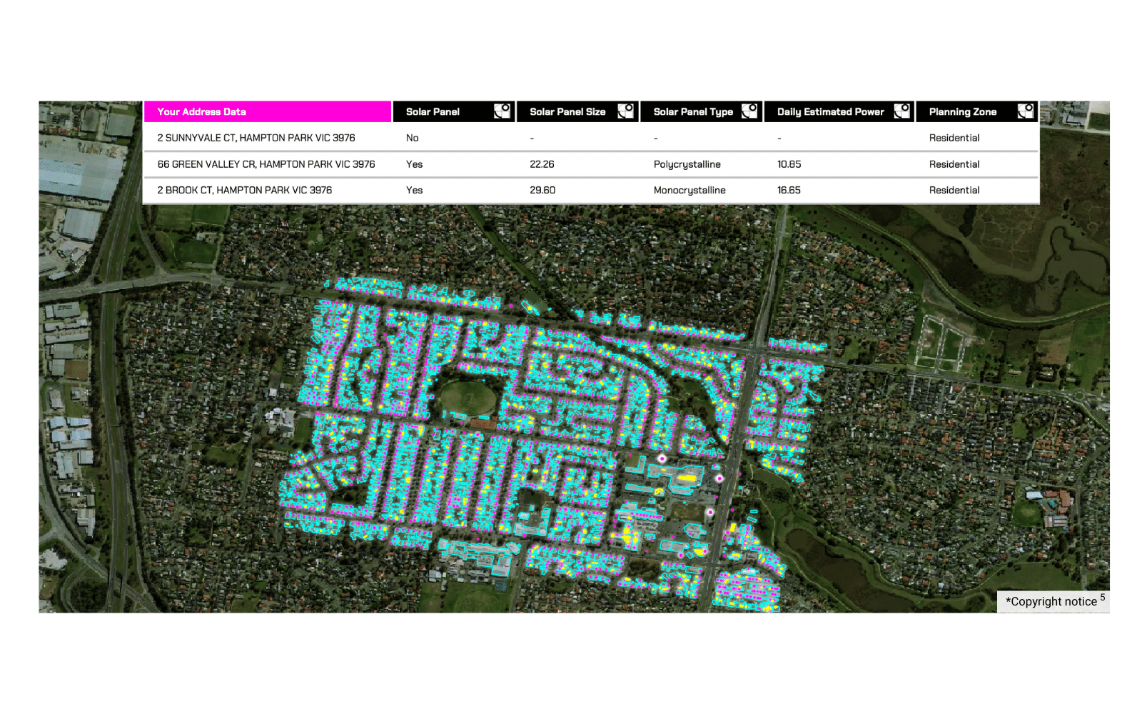
Copyright notice 5 – Created using aerial imagery © Aerometrex Ltd 2022, and Geoscape Buildings, Geoscape Solar and Geoscape G-NAF © Geoscape Australia 2022 Copyright and Disclaimer Notice.